Ola, Portugal!
- Jul 8
- 78 min read
Updated: 17 hours ago

Exploring Portugal: Our first expedition 🔍
This post is the first of a series on our Portugal wanderings. Portugal is a country we have grown to love after multiple opportunities to experience its natural beauty, warm people, and whitewashed and stone buildings. Our first trip was in May 2024, the subject of this post. I've included some background below to give context to our experiences to date.

A little bit of background 📝
Why Portugal? I'm something of a Europhile. The history, and architecture, and the landscapes speak to me in ways that make me feel intimately connected to the countries I have visited. My husband (referred to as W in my post) and I are at the point now where we are thinking about the next chapter - retirement (eek). I've always wanted to spend more time in Europe, after having travelled to the UK and Europe many times for work and for personal travel. Spending blocks of time in Europe - potentially with a base somewhere - is something we have been talking about for as long as I can remember. Now, finally we are thinking seriously about it.
We were planning to travel in 2024, our first trip just the two of us for almost twenty years and our first trip together since 2018. As we were doing our planning I started to see Portugal regularly featuring at the top of lists of desirable places to live and work or retire. The country has become a sought-after destination, due in part to visa possibilities, the climate, and cost of living. We'd never been to Portugal, so we decided to check it out. Our Portugal wanderings have been framed through the lens of an eventual base there, even if only for extended blocks of time. My posts in the Portugal series reflect this approach to our experiences.
Flying with Qatar Airways from Brisbane to Lisbon usually means a long layover in Madrid. Instead, we decided to hire a car and drive in and out of Portugal from Spain's capital city. This plan meant Spanish bookends were part of our wanderings. There's more background on our decision making and journey to Madrid in my Spain post.

The below map gives an idea of the parts of Portugal and Spain that we explored. I've marked the places where we stayed. After flying into Madrid we headed southwest into Portugal, explored central and northern parts of the country. Then we drove back to Madrid from Northern Portugal to return to Australia. You can read all about the Spanish part of our experience here.

So...this post is all about our first Portugal experience. We were away for two and a half weeks in May 2024, inclusive of the three days it takes us to get to Europe and back again and our Spanish bookends. Our planning saw us focus on three parts of Portugal:
The Gateway to the South: Setubal and Lisbon
The Silver Coast, including a night in Nazare where the big waves come crashing in during winter
Central Portugal: Coimbra district, including more of the Silver Coast and the Estrela mountain range
Northern Portugal: Porto and Braga district, including the Douro Valley wine region and Geres, the country's stunning national park near the Spanish border.
We absolutely fell in love with Portugal on that trip! The country's stunning natural beauty absolutely blew us away. We well and truly left our hearts in Portugal and will continue to feel a strong bond with the place.

Ola, Portugal!🍇
We were super excited at the prospect of entering Portugal in the afternoon of our second day. My Spanish post documents our journey from Australia and our first night in Talavera de la Reina after leaving Madrid airport. Our journey on Day 2 took us 475 kilometres through the central-western edge of Spain and across the width of Portugal to the Atlantic coast at Setubal, south of Lisbon. Yep, that's the width of the whole country in one day!

Our first experience of Portugal was the Very Noble and Ever Loyal City of Evora (ev-er-a), an ancient city that sits about halfway between the Spanish border and the Atlantic Coast. The old town centre has been beautifully preserved and is still partially enclosed by medieval walls. It has been a UNESCO World Heritage Site since 1986.
We parked our car at the foot of the hilly old town and walked up to the town centre, our first experience of the cardio stairmaster that is much of Portugal.


Evora is the historic capital of the Alentejo region of the south-central part of the country.
Its history goes back 5000 years when it was originally known as Ebora, a name given by Celtic tribes who settled in the area.
Evora was eventually conquered by the Romans in 57 BCE, turning it into a walled town. Then it was under Arab rule for a bit, then came under the rule of Portugal's first king, Afonso I in 1166.
I'd like to return to Evora and have a proper look around. We wandered around the old town for a bit, but were keen to keep going to our eventual destination of Setubal. It had been a big day of driving after our long flight from Australia. Still, we had the chance to take in our first glimpses of Portugal and its distinct architecture.

One of the key historical structures in Evora is its Roman temple. It is part of the historical centre of the city, located in the central square, in what would have been the highest elevation of Evora's acropolis. What remains of the temple is its complete granite base, the ruins of a staircase, an intact colonnade and a bunch of columns. I just stood in front of the temple and marvelled at something so ancient, set against the backdrop of the whitewashed buildings in the square.

The temple is one of Portugal's most significant Roman and Lusitanian landmarks.
The original structure was likely built in the first century, in honour of Emperor Augustus, the founder of the Roman empire.
The temple was partly destroyed in the 5th century by invading Barbarians.
The temple was a 14th century safe house in the city's castle and later a slaughterhouse.
The temple may have been once surrounded by a reflecting pool. Traces were found of the pool during excavations in the 1990s.
Our wanderings took us up the hill from the car park, through the old town, and along Evora's ancient walls. It was such a nice walk on a warm afternoon, the pretty greenery and gardens set against the stone enclosure. The ancient walls are well preserved and the pathways along them are easy to navigate. The bottom right-hand shot below shows where we parked, beneath a massive set of arches. The arches are part of the Aqueduto da Agua Prata (the Silver Water Aqueduct), a marvel of 16th century architecture, built to bring water to the city. So cool!

The Roman enclosure (Cerca Romana) has been a National Monument since 1922.
The enclosure makes up a defensive system that has been built up over the centuries.
The walls have been maintained in pretty much their original condition since their construction in the 15th century, although the oldest part of the wall actually dates back to the 3rd century.
There are distinctive designs to the walls that correspond with the periods of history in which they were built.
Evora was quite busy that day and I imagine it's a popular place to visit. After returning to our car we battled the traffic and the cobblestone roads to find a supermarket for supplies and a loo, before heading to Setubal (shtoo-BAHL). Then we arrived in Setubal at rush hour which was a little stressful to be honest. European towns tend to feel crowded easily as they weren't built for modern populations. Fortunately we found our Airbnb apartment easily enough. It is located on Rua 19 de Abril, just off Avenida Luisa Todi, a beautiful wide, tree-lined main thoroughfare through the heart of the old town. It was lovely to be so central, with supermarkets close by. Our old town explorations were all able to be done on foot.

The apartment we stayed in is housed in an old building. It's been lovingly renovated, though, and it is fresh and clean inside. I loved the decor and the colours the owner has chosen to paint the exterior. It's a small ground-floor apartment, but it suited our needs for three nights. My photos show the corner location of the apartment down a narrow street. The white interior double doors (top right-hand shot) openg right onto the street. Our three-night stay cost $430AUD.

Parking was a bit tricky as my photos show. On one of the nights we parked near the cafe (bottom row above) and ended up with a parking fine. Leaving Setubal in the car to explore our surroundings was something of a gamble on return! It involved a little manoeuvring to park the car. We live in a suburban part of our city in a detached house with a yard and a driveway. Our apartment in Setubal was nothing like that, so it was fascinating to experience such a different way of living.
Setubal and surrounds 🏖️⛰️
We chose Setubal as a base for three days as we preferred to be out of Lisbon and I liked the idea of staying somewhere less popular. Setubal is known as the "gateway to the south". It sits at the northern tip of the Alentejo (ah-len-TAY-zhoh) region that stretches down to the famous Algarve. The below map shows the parts of Portugal that we explored from our Setubal base.

Setubal city and municipality lie within the Lisbon metropolitan area, 50 km south of the capital city.
The city is sits on the northern bank of the Sado River estuary, protected from the Atlantic Ocean by the Troia Peninsula.
Setubal is a port city, surrounded by beaches and the Arrabida Natural Park
The city was once the most important centre of Portugal's fishing industry, particularly for processing and exporting sardines.
On our first morning we strolled along the main avenue and the port, heading to the fort that overlooks the city. Below is the view of the fort from the old town centre. If it looks a long way and high up on the hill, that's because it is! To be fair, the walk from our apartment only took half an hour but the climb up to the fort was excruciating!

Forte de São Filipe de Setúbal (the Fort of Saint Philip of Setubal) is free to visit. It's a magnificent structure, standing proudly on the hill overlooking Setubal and the mouth of the Sado River. The cloudy early start morphed into a beautifully sunny morning and we caught our breath at the top to take in the magnificent 360 views. The view is totally worth the climb. How pretty is Setubal from up there?

Forte de São Filipe de Setúbal was built in 1582 during the Spanish occupation of Portugal, on the orders of King Philip II of Spain (married to Queen Mary).
There had been previously been some construction of a defensive structure in the 14th century, to protect Setubal from attacking pirates and corsairs from North Africa.
Lower batteries were added in the 17th century to cover river access from the port.
The fort has been classified as a National Monument since 1933.
We had a lovely poke around the fort. It was here that we had our first experience of the rather different view of safety standards in Portugal. There was a group of men whipper-snippering the green spaces on and around the fort, precariously perched, without any safety equipment. during the Wild. Oh, and the whipper-snippering? We saw people all through our travels using whipper snippers for cutting grass. Are there no mowers in Portugal?

Walking back into town gave us the chance to take in some more Portuguese architecture. You can see some examples in the below collection. Calcada portuguesa is the name of the traditional cobblestone mosaics that pave footpaths, plazas and squares. The patterns sometimes feature wave motifs or geometric shapes in a nod to Portugal's maritime history.
The buildings we had seen so far were mostly whitewashed with a splash of colour, similar to Greek architecture. The few churches we'd seen at that point were also whitewashed, with simple ornamentation on the inside, much less ostentatious that churches I'd previously be into in Europe. I mist admit to being a bit shocked by the general shabbiness of Setubal's buildings. We have come to understand and appreciate that Portugal has magnificent natural beauty, but it does feel neglected in place. The rundown vibe is unashamedly Portugal.

The bottom right-hand shot above is of the Mercado do Livramento on Avenida Luisa Todi near our apartment. It was opened in 1876 and is the main fish and agricultural products market in Setubal. Check out the giant fish in the foreground! It's a bit odorous in the market, as you can imagine, but fascinating to wander through and marvel at a different way of food shopping.
Back from our fort wanderings, we headed south of Setubal to explore the northern part of the Alentejo coast. Before we headed out of Setubal, we stopped at a Continente centre, purchasing a padded collapsible cooler bag from the Decathlon store. Poking around foreign supermarkets and eating local produce is totally our jam and we've used the cooler bag on each trip to Portugal since, adding a picnic set and rug to our essential travel items. We found the food in Portuguese supermarkets to be fresh, good quality, and cheaper than Australia. We had a lovely time with our picnic lunches in various parts of the country. We discovered Continente for the first time that day. It is the largest chain of hypermarkets and supermarkets in Portugal, owned by the Portuguese retail conglomerate Sona. Continente is similar to the Asda chain in the UK, stocking food and household goods. It is a cross between Kmart and Coles or Woolies in Australia.

Our afternoon exploration took us to Comporta and Sines. Comporta is marker 3 on the above map. It lie about an hour's drive south of Setubal, on the opposite side of the bay. Comporta is apparently known as the Hamptons of Portugal (and of Europe). The town is actually a series of small beachfront villages. There are loads of posh homes and rental apartments and chic boutiques, giving the area its "hippie chic" moniker. We found the place decidedly empty of traffic and people and surprisingly desolate. It looked to us as if the fancy resorts and homes were still being built. I do know that quite a few famous people have homes in the area, including Princess Eugenie, Prince Harry, the Clooneys, Christian Louboutin, and more recently, Nicole Kidman. Perhaps we weren't in the right part of the poshness?
We did find a lovely beach for our picnic lunch, but the weather took a turn for the worst so we ended up eating our food sitting in the car in the car park. What we learned that day is the Portugal's beaches on the Atlantic Coast can be super windy.

After lunch we drove further south to Sines, a pretty beach town and main fishing harbour of the Alentejo region. Sines (SEE-nesh) is another Portuguese town with a long history. You can see the remnants of the castle that was built in 1362 to protect the town from pirates in the bottom left-hand shot. The two top photos were taken after we climbed up to the castle. More climbing! The sun had come out again so we were treated to stunning views of the harbour and Praia Vasco da Gama. [Note that praia is the Portuguese word for beach, pronounced PRY-ah.]

Sines was once used by the Romans as a port and industrial centre.
The town was occupied by the late antiquity Visigoths (from the Balkans) and later sacked by the Moors. Stone remnants of the Visigoth era (7th century) can be found in the town.
Sines is the main fishing harbour of the Alentejo and the only marina between Setubal and the Algarve. Now it is the Atlantic endpoint of China's global expansion on the Maritime Silk Road and a key global shipment hub connecting Asia, Europe and the Americas.
The town is most famous as the birthplace of Portuguese mariner and explorer, Vasco da Gama (1460-1524). He discovered a direct route from Europe to India via the Cape of Good Hope and from Kenya, opening up European exploration of, and commerce with, India. There is a statue of da Gama between the church and the castle you can see in the bottom left-hand photo of the above photo set.
The below collection has some of the shots taken at the top of the hill near the castle. You can see the church (where de Gama was christened) and the whitewashed buildings in the old quarter of Sines, looking a bit like homes I have seen in Greece or Morocco. The middle shot of the Vasco da Gama monument was taken from Wikipedia as I didn't take a photo myself. If I am recalling correctly, the grass was really long around the statue. I'm also not prone to taking shots that celebrate colonisation, and although I do recognise that da Gama was a mariner and navigator. He was also the Portuguese Governor of India in 1524.

We had taken the highway down the coast and decided to take an inland, minor road back. We were treated to lots of pine forests, cork oak trees, and rice fields. It also took a lot longer to get back to Setubal than our earlier journey on the highway. There were farm vehicles to contend with on the minor road. The dry, mostly cork plantation landscape was quite different to what I thought Portugal would be!
Our second full day in Setubal saw us exploring the Arrabida Natural Park (Parque Natural da Arrábida). Arrabida covers most of the southern part of the Setubal Peninsula that sits across from where the Tagus River empties into the Atlantic Ocean at Lisbon. One of the key architectural features of the park is the Convent of our Lady of Arrabida, a 16th century monastery. We didn't visit the monastery but took a long drive up and down the park's winding roads. This was our second experience of Portugal's rather laid-back approach to safety. Some of the roads were terrifying, absent of safety barriers. It sure is pretty, though!

Arrabida was designated in 1976, occupying an area of 176 square kilometres on land and 53 square kilometres at sea.
The park is made up of the rocky Arrabida carbonate geology cordillera - a chain of parallel mountains - and several typical Portuguese beaches of long stretches of sand and rocky cliffs.
It was designated a biosphere reserve by UNESCO in 2025, the year after our visit.
We wanted to do a hike in Arrabida, but we couldn't find a reliable source of information about the park's trails. Eventually we signed up for a hiking app and tried to find something that would take us through the park at the beach level. Somehow we stumbled on one of the beach hikes after parking our car. We spotted other cars parked and followed some people up yet another giant hill to the start of the hike. After a gruelling walk up the hill, we found ourselves (eventually) at Praia do Ribeiro do Cavalo, one of the popular beaches in Arrabida. It's classed as a wild beach and we soon found out why. To get to it requires a trek down a path amongst the bush and a scramble down a rocky cliff, as my photos below show. This is beach access Portuguese-style, complete with the warning signs about the unstable cliffs! [Note that the beach name is pronounced PRY-ah doo hoo-ABY-roo doo kah-VAH-loo.]

Below are some more shots of our journey down to the beach. The shot of me and the one on the bottom left-hand side of the collection show what the path looks like at the start of the hike. It's not too bad at first, then it becomes a rocky climb down to the beach, as the other photos show. We wondered about our decision several times along the way, but kept going and just rolled with it. I can say with certainty that this was a first for me as a pathway to a beach!

But, boy, was the treacherous climb worth it! Just look at the beautiful shots I took once we were down at the beach! It was a Saturday morning in May when we were there, but there was hardly anyone around. The water is clear, the beach is clean, and the whole place feels so secluded.

We just sat and took it all in, marvelling at our climb down and the rocky (and definitely unstable-looking) cliffs behind us. I wouldn't recommend doing the hike with small children or anyone unsteady on their feet, though. Wearing sneakers (or hiking boots even) is a must. The trail is easy enough to follow for the most part, as it's been carved out by many others before. However, it is slippery even in dry weather and I imagine the trail might be hard to discern after rain. I found a comment from a user of the Komoot hiking app that says the beach isn't marked on any maps and only a few locals know of the trail leading down to it. This is what I love about world wanderings, finding the hidden gems and experiencing the unexpected.

After that wild experience we drove around nearby Sesimbra (suh-ZEEM-bruh) at the foothills of the Arrabida mountains. The roads are narrow and it was quite busy by then. We even headed down a steep road and got stuck, as there was nowhere to park. We ended up at Praia do Creiro (PRY-ah doo CRAY-roo), halfway back to Setubal, and had a late picnic lunch on the beach.

Our final moments in Setubal were spent wandering down the pretty Avenida Luisa Todi that runs through the main part of the old town. Setubal was a wonderful proper introduction to Portugal after our first taste in Evora on Day 1. It's shabby in places, but the port is pretty. There's plenty of natural beauty to explore with Arrabida and beaches surrounding the city. Setubal, we definitely heart you...

We found a cool gift shop in the centre of Avenida Luisa Todi on our last afternoon, one of those places with crafty, traditional stuff rather than tacky souvenirs. I bought a gorgeous print of an Arrabida scene, a cute sardine key chain, and the little ceramic unloader's hat, once used by traditional Portuguese fisherman.

Lisbon and the southern end of the Silver Coast 🔷🏄🏼♀️
The next part of our journey saw us visit Lisbon and the the southern end of the Silver Coast (Costa de Prata). You may not have heard of the Silver Coast. The name refers to the stretch of coastline from Lisbon to Porto, named after the silvery light of the Atlantic Ocean. The Algarve in the very south of Portugal is the most well-trodden tourist beat. It is an area that has given in to resorts, golf courses, and British pubs. It's very busy with tourists and international residents, similar to the "Costas" in Spain. The Algarve the Silver Coast most definitely is not!
The Silver Coast has retained its wild charm and it has remained largely authentically Portuguese. Resistance to the tourist onslaught is due in part, I think, to the steep rocky cliffs that frame many of the beaches, buffering against the force of the Atlantic Ocean. I'd also suggest another factor is the inaccessibility of the coastline relative to the ease of enjoying the sheltered beaches of the Algarve.

Leaving Setubal on Day 5 we drove the short distance to Lisbon, Portugal's capital city. I was excited to see the city and wondered what it would be like. It was a Sunday morning when we visited so there was a buzz about the place in the city's heart. The sun came out mid-morning so it was easy to feel the warm glow of the ancient city. These photos show some of the good bits.

Lisbon is the City of the Seven Hills! It sits on the northern bank of the Tagus River that flows into a wide but shallow estuary, providing protection since Roman times from the ferocious Atlantic Ocean.
Lisbon is one of Europe's oldest capitals, founded by the Phoenicians and later developed by the Roman Empire under its original name, Olisipo. A bunch of Germanic tribes ruled from the 5th century. The Moors had a go in the 8th century, then the city was reconquered in 1147 by the first king.
Lisbon has been the country's capital since 1256, replacing Coimbra.
The city flourished in the Age of Discovery from wealth generated by maritime activities, becoming one of the world's major ports. This era saw the development of the ornate Manueline architectural style seen throughout Portugal.
A catastrophic earthquake in November 1755, followed by tsunamis and fire, devastated the city, killing 60 000 people.
Of note is that Lisbon is now amongst the most populous urban areas in the European Union with close to 30% of the country's entire population residing there.
Our route to the city gave us the opportunity to cross the magnificent Ponte 25 de Abril, (the Bridge of 25 April), the massive suspension bridge that crosses the Tagus (taa-gus) River connecting its south bank with Lisbon. The bridge is rather a magnificent sight as it looms large on approach to the city. I love a good bridge, so it was super cool to drive across it. The bottom shot below is taken from a video I made as we travelled across the bridge.

Ponte 25 de Abril is named for Freedom Day (Dia da liberdade), the peaceful 1974 military coup that overthrew the authoritarian regime.
The bridge pays homage to the San Francisco-Oakland Bay Bridge - built by the same company - but painted the Golden Gate Bridge orange.
The bridge is a 70 metres tall and 2.3 km long road and rail bridge. The lower section is used by trains.
It was built between 1962-1966, at a cost of €800 million from foreign loans.
Our first experience of Lisbon was our struggle to find a park. Not for nothing is Lisbon known as the city of the seven hills! It is definitely is hilly, with lots of buildings squished together along narrow roads. We drove around for ages and wondered if we'd ever find a place to leave the car, not yet brave enough to try parking buildings. Finally we found somewhere on the street in the Graca neighbourhood. I hoped we could find the car again! I also hoped that we didn't end up with fine, as we couldn't see where to pay to park.
Graca (GRAH-suh) is the highest and most authentic of Lisbon's neighbourhoods. It has a village-like feel to it, with lots of coloured buildings and eclectic street art. Parking in Graca meant only a short walk to Miradouro da Senhora do Monte, one of Lisbon's many lookouts, facing westwards and sitting at the highest point of the neighbourhood. We came to learn that there are miradouros everywhere in Portugal, taking advantage of its hilly landscape to afford a deep appreciation of the country's natural beauty. [Note that miradouro is the Portuguese word for lookout. Miradouros are everywhere in hilly Portugal!]
Miradouro da Senhora do Monte lies in the churchyard of the Capela de Nossa Senhora do Monte, a chapel site since 1147. The panoramic views of the historic city are awesome! It is possible to see across the entire Baixa (BYE-shah) district and out into the Tagus Estuary. We were so fortunate to have a fresh but sunny morning to admire the beautiful city.

On our walk down to the city centre along the narrow, cobblestoned streets of the Graca neighbourhood, we were lucky enough to watch one of the famous Lisbon trams go by. The below shots are stills from the video that I took. I'm not sure if my photos quite capture it, but the tram was so close to us as it passed by. Check out the narrow pedestrian path where we were standing! I was tempted to breathe in as the tram passed by!

Lisbon’s iconic yellow trams (elétricos) have been operating since 1873, firstly as horse-drawn trams. By the 1950s, there were 27 tram lines. There are only five lines left.
Today the trams are mostly a tourist attraction. Some locals use to navigate the steep Lisbon streets that rise to a gradient of 14%.
Take Tram 28 for the best experience. The route is a 40-minute journey up (or down) the hill passing through the historic neighbourhoods of Graca, Alfama and Baixa.
We only spent a few hours in Lisbon as we just wanted a taste of the city. Our first exploration of Portugal was designed to give us an overall impression of the place. We didn't do any touristy things, just walked down to the Praca do Comercio, the square that sits adjacent to the Tagus. [Note that praca is pronounced PRAH-sah.]
It is possible to see the Ponte 25 de Abril from the square and appreciate the size of the Tagus estuary. Once upon a time, anyone arriving by boat disembarked at the square. The square still retains its grandeur despite the damage it endured during the 1755 earthquake and tsunami that destroyed the royal palace, Paço da Ribeira (PAH-soo duh rhee-BAY-ruh).

The square is huge! It's also very white and I found myself struggling with the sun's glare as we hadn't brought sunglasses with us. I read on an architecture blog that the city is bathed in an unusual light, reflecting off the water onto the tiled streets. You can compare where I am standing, in front of the statue of the king, with the size of the square. It's a rather impressive space, surrounded by lemon-coloured facades and mosaic cobblestones. The square has a long history as a place for major public gatherings, state events, and demonstrations.

The 14-metre-high statue in the centre of the square is of King Jose I on his horse, Gentil.
The statue was created by Joaquim Machado de Castro that was unveiled in June 1775.
The king ruled during the earthquake and the statue was made as part of the reconstruction of the new square amidst the palace ruins.
The statue was the first equestrian statue made in Portugal and the first public one dedicated to a living person.
My favourite part of the square is the Arco da Rua Augusta. It feels like a gateway to the city into the Baixa district. I love the way it frames the streets behind it. The archway was built to symbolise Lisbon's resilience after the devastation of the 1755 earthquake. My photos show the perspective from the square looking down to the street and from the street looking towards the square. You can just see the statue in the distance in the middle shot, framed by the arch. So cool.

The arch consists of six columns with carvings of key Portuguese figures and the country's coat of arms.
At the very top stand the impressive sculptures of Glory crowning Genius and Valour.
The sculptures show a female allegory of Glory, seated on a throne holding two crowns. Then there's Valour embodied as an Amazon warrior. Thirdly, we have Genius with a statue of Jupiter behind his left arm, adjacent to symbols of writing and art.
We enjoyed wandering around the Baixa and soaking up the vibe of the city. The architecture reflects the Roman and Moorish conquests of the past and the monarchy, republic and dictatorship of its recent history. The streets are so pretty in this part of the city, lined by trees and coloured buildings.

Lisbon is a city of hills and of colourful buildings in Lisbon. The below shots were taken in the Graca neighbourhood. Some of the buildings have with mosaics on their exterior facades. These brightly coloured patterned tiles are known as azulejos, designed for both aesthetic and insulation purposes. [Note that azulejos is pronounced ah-zoo-LEH-zhoosh.]

I never miss the chance to marvel at old doors. It's kind of my nerdy thing to do. We live in a country with one of the oldest cultures in the world yet it is a culture that is not expressed through buildings. It's the land that provides visibility to this culture, at least in the places where most Australians live. I am fascinated by pieces of history that blend into everyday life, where remnants of the past are so visible.

We were lucky to have a brilliantly sunny day as we wandered around. There is a lot to see and do in Lisbon and we will certainly be back in the future to deepen our exploration of the city.
After wandering around the central part of the city, we trekked back up to the car. I am still amazed we found it again! I tried to capture the Lisbon hills in our climb back to the car, but I am not sure that my photos in the below collage quite do the gradients justice.

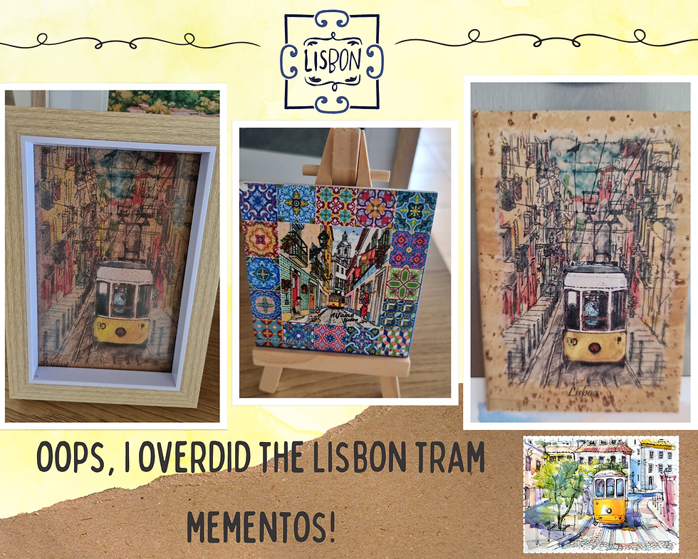
Here's one last set of shots from our Lisbon wanderings. As it says in the collage, I kind of overdid the Lisbon tram mementos. There are lots of souvenir-y things I could have bought, but I stuck to the trams. These little mementos capture the essence of Lisbon. I think.
We left Lisbon and headed north for 50 kilometres to our first stop on the Silver Coast: Ericeira. As I mentioned earlier, the Silver Coast refers to the stretch of coastline from Lisbon to Porto, named after the silvery light of the Atlantic Ocean. Ericeira (eh-ree-SAY-rah) is one of the more popular beaches of the Silver Coast partly because of its proximity to Lisbon. It's a surfers' mecca and a classic example of the beaches along that part of the coast - rugged cliffs, clear blue water, and golden sands. There are loads of whitewashed apartment buildings lining the esplanade and the whole place has a laid back vibe. We found a Lidl and bought picnic lunch supplies. We ended up eating in the car because of the wind, but check out the stunning views.

Santa Cruz is a further 25 kilometres up the coast and like Ericeira, it has jagged cliffs that require a climb down from the town to reach the beach. The strong, consistent winds coming off the Atlantic Ocean make the Silver Coast a world-class water sports destination, but I am not sure how much sitting on the beach is possible in such conditions. Perhaps the wind is the reason why the Algarve is more popular with sun-seekers. It's more sheltered on the southern-facing coast and away from power of the Atlantic. It wasn't cold when we were there, but it sure was windy!

The Silver Coast winds pick up between June and September due to the annual summer north wind phenomenon (nortada) combining with the exposed western coastline and powerful Atlantic Ocean currents.
The science of the winds also has something to do with the high-pressure systems over the Atlantic Ocean and the thermal low-pressure systems over the Iberian Peninsula during the warmer months.
Our resting place for the night was to be Nazare (nuh-zuh-REH), another of the Silver Coast's prominent beaches. I had a list of beaches to check out but had also heard about Obidos, a town about 20 kilometres inland and still considered to be part of the Silver Coast. Obidos (oh-bee-doosh) has an ancient history, its region extending from the Atlantic to the historical Estremadura province since Paleolithic times (now the Oeste region of Portugal). There's the town itself to wander around and the ancient walls that surround it. The castle within the fortification was converted into a hotel in 1951 - the Pousada - and it has retained many of its medieval features. It was one of the filming locations in The game of thrones.
We parked below the fortified town and walked up. The first thing we noticed before entering the town itself were the stunning views of the countryside. The landscape looks like a lush green carpet from up there!

Obidos became our second experience of wild Portugal after our climb down to rocky cliff to Praia do Ribeiro do Cavalo. That was WILD, but the ramparts of Obidos Castle were like nothing we'd seen before. Now, I need to point out that it is your personal responsibility to make the decision to climb up and walk along the 13-metre-high battlements. It's free to walk along the walls, but there is no official entrance and there are signs warning visitors away. We hesitated a bit, to be honest, as we weren't sure if were supposed to be on the walls. We saw other people up there and we thought, "why not, we're here now."
Castelo de Obidos dates back to Roman times. It was built as a fortified settlement on the hilltop of Eburobrittium.
The Moors created their own layout in the 8th century and many modifications have been made by various Portuguese kings since 1148.
The castle is rises almost 80 metres above sea level and is surrounded by well-preserved walls that also enclose the town of Obidos.
The castle was given as a wedding present by King Dinis to Queen Santa Isabel (Elizabeth of Aragon) during their wedding there in 1282.
To complete the circle of the town along the castle's ramparts requires a 1.5 kilometre walk along narrow ledges. It is as dangerous as all get out, as there are guardrails. The paths are littered with protruding stones and branches from trees with the town enclosure, so you need to be careful not to trip. Oh, and it can be tricky when other people pass by. At one point we came across a group of people coming the other way who visibly panicked at the thought of having to navigate past us. You can see what I mean in the below photos, although they still don't quite capture the precariousness of our adventure. There are multiple sheer drops down to the town below with no barriers or railings. It would be fatal if you fell. The whole thing was utterly surreal.

Despite the danger, it's pretty amazing to be able to walk around the battlements. The complete circuit of the walls provides such unique perspectives on Obidos town and the surrounding countryside. It's also super cool to gain a proper appreciation for the scale of the walls and all the different architectural features. Given my woeful balance, I was rather proud of myself for embracing this wild experience. It symbolises so much about Portugal in all its untamed splendour.

Obidos itself is very much built in the traditional Portuguese style of whitewashed buildings with a splash of blue and yellow. The town is adorable, although I imagine living there would be challenging with all the tourists stomping about. Obidos is also known for its chocolate and there's even an international chocolate festival held there in March each year.

We had a little wander around after we came down from the walls. It was quite crowded and I'm glad we braved the walls so we could get a better perspective on the town. We were coming to the end of a long day and we still had to drive to Nazare where we were staying that night. I bought a few mementos of our visit from a gorgeous little shop.

Before we left Obidos we had a poke around the bookshop in the converted church near the entrance to the town. The Church of St James (Igreja de Santiago) was built in 1186, sadly destroyed in the 1755 earthquake and rebuilt in 1772. Very cool.

We only had to drive a further half an hour north to Nazare but it had been a huge day and we couldn't stop thinking about the mad castle walls at Obidos. The lack of safety measures in Portugal and the zero f**ks given attitude is wild!
Anyhoo, arriving in Nazare turned out to be another tricky location and parking situation. I'd booked the centrally-located apartment through Booking dot com. We easily found the address given in the listing information and a giant unpaved public car park close by. We walked the short distance to the apartment and stood in front it, confirming that the address we were given by the owner matched the photos on Booking. The owner messaged me then to ask where we were. At the apartment, right? It turns out that we were in the wrong place. After much confusion, we located our host standing on the street in front of the correct apartment. OK, cool. We couldn't get to the bottom of our confusion due to the language barrier. Not to worry, we sorted it out in the end.

The host was super nice and friendly, despite our communication challenges. We had to be shown all around the apartment before she would leave so we just smiled and nodded a lot. Our experience of Portuguese people is their warmth and friendliness. There's a sense of authenticity about the whole country, actually. So...we were happy to have found the right apartment and we managed to work out the parking situation. Later, we moved our car to the designated spot under the building, as it was safer than the public, loose-metal car park. After the modern place we stayed at in Setubal, this was our first experience of traditional Portuguese design. The apartment is spotless and in good condition for its age, just very brown...
Our journey to Coimbra; Nazare, Tomar and Fig Foz 🏄🏼♀️🏰
We instantly warmed to Nazare. It's a pretty town sitting alongside a stunning flat sandy beach, flanked by the Sitio hills to the north and the Pederneira (pe-der-NEI-ruh) to the east. The seaside town is actually one of the most popular on the Silver Coast, largely for the surfing. The winter waves are HUGE and there's an international surfing competition at Nazare each year. We were in Nazare in May so the Atlantic was flat and the town wasn't busy.
The below photos were taken when we took a stroll along the esplanade the morning after our arrival. The massive, flat stretch of sand is protected from the powerful Atlantic by the Sitio headland that can be seen in the top shot. Finally, a flat beach!

Nazare is a town named from the Portuguese word for Nazareth. Legend says that the name came from a small wooden statue of the Virgin Mary that was brought from the Holy Land via Merida in Spain to the town in the eighth century.
As the time of writing this post, the record still stands in Nazare for the tallest wave ever surfed. The wave measured 26.2 metres, surfed by German boardrider, Sebastian Steudtner in 2020.
The esplanade stretches to the foot of Sitio. It's actually a lovely walk up to Sitio from the centre of the town, along the mosaic-tiled esplanade and past some pretty houses before making the climb up. It's super steep, though, rising to 110 metres above sea level. Yep, yet another Portugal cardio stairmaster situation! The marked path is easy to walk up and down, built in a switchback style (below middle shot).

My photos show that the gruelling climb is worth it. Look at the view of the beach and the town! There is a funicular if walking isn't your thing and you can drive to the Sitio neighbourhood from the other side of Nazare. The Sanctuary of Our Lady of Nazare, built in 1377 and housing the Virgin Mary statue, is located in Sitio. There are craft shops and cafes to poke around in when there are no waves to marvel at, if visiting in summer.

We walked down to the viewing area on the headland of Praia do Norte, the beach that holds the surfing competition. The headland is on the other side of Sitio from the main Nazare beach and the town. It is hard to believe that the waves can be so high in winter when what we saw was the flat springtime ocean.

We would return to Nazare the following year on our second Portugal adventure, this time in winter so we were able to experience the giant waves at Sitio de Nazare. I know the town attracts large volumes of tourists, but I really love it there. The pretty buildings that lead down to the beach, the huge stretch of flat sand, and the incredible views from the Sitio are all examples of what we love about Portugal.

We left Nazare mid-morning on Day 6 of our journey and headed inland to Tomar, home to a super cool Knights templar castle. Our journey that day took us from Nazare to Coimbra in Central Portugal, where we spent the next four nights. We travelled via Tomar and Figueira da Foz, covering 250 kilometres.

This is Tomar (toh-MAHR) is a city and a municipality in the historic Ribatejo (rhi-buh-TEH-zhoo) province in the Santarem district of Portugal. This region is the true centre of Portugal as there is no coastline or border with Spain. Ribatejo is home to Portugal's most fertile agricultural land (mostly olives and figs), and Tomar is framed by a lush landscape. There's a compact (and flat!) historic centre that reflects the town's medieval origins. We parked near the river and had a wander around, capturing the below shots to showcase the pretty surroundings. That's the Nabão (nuh-BOWN) River you can see, forming a key part of Tomar's landscape. The river flows fast, but we still felt at peace there. Stunning!

Oh, and the sculpture of the two men in conversation on a park bench represents Fernando Lopes-Graça and Fernando Araújo Ferreira. It was created by the sculptor Rui Fernandes. The monument celebrates the men's friendship and their lasting contributions to the cultural and intellectual life of Tomar. Fernando 1 was an influential composer, pianist and conductor, and Fernando 2 was a physician, writer and cultural advocate. It is just so Portugal to have a memorial to two men, chilling on a park bench, deep in conversation.
Tomar was founded in the 12th century by the Grand Master of the Knights Templar of Portugal, Gualdim de Pais, as a fortified town.
The Templars were eventually suppressed. The town then became a major part of Portuguese global expansion under the Templar's successor, the Order of Christ, led by Henry the Navigator (1394-1460), a Portuguese prince and key figure in the Age of Discovery.
The streets and squares of the town centre are in a chessboard pattern. Apparently this is a rare feature for a mediaeval city.
Again, Prince Henry was responsible! His work in Tomar later inspired the pattern used for the rebuilding of Lisbon after the 1755 earthquake.
Today, it is still possible to see the remnants of the Templar history in Tomar. The city is watched over by the Convent of Christ (Convento de Cristo) and the adjoining Castle of Tomar (Castelo de Tomar), together recognised as a UNESCO World Heritage Site since 1983. Tomar is worth a visit for a stroll around the pretty town, but it's the convent and castle that have left a lasting impression on us. The convent and castle are part of the one complex. The complex is surrounded by a sprawling wooded forest and there's a 16th century aqueduct that once brought fresh water to the convent. The castle grounds are free to wander around but the convent has an entrance fee of €6 (at the time of writing).

It is possible to walk up the hill to the castle from the town (as we did on our second visit), taking around 15 minutes ascending a steep but easily-navigated path. We drove up to the castle and had no trouble finding a park, although there are limited spots. Hilariously, there was a dude at the side entrance to the castle dressed in medieval costume trying to convince us to pay him to get past. I am not sure if he is a sanctioned fee collector - possibly not!
Castelo de Tomar was founded by the Templar knights in 1118. It was a key part of the defence system against the invading Moors.
The templars were a military order of the Catholic faith, founded to defend pilgrims on their way to Jerusalem. The order existed for nearly two centuries during the Middle Ages.
The templar order was dissolved in 1319 and the castle transferred in 1344 to the Knights of the Order of Christ (hence the name, the Convent of Christ), a military order that still exists today.
The castle is in good condition considering it's almost one thousand years old. We had a lovely wander around the grounds and I had to keep reminding myself that I was walking around an actual templar castle. I know the Crusades were a terrible part of history, but the Templar castle is way cool. That said, it is the convent that absolutely blew me away. The place is massive, and includes the main church (the circular Charola), eight cloisters, a refectory, dormitories (where the knights and monks slept), and a vestry.

The Charola is among Europe's finest surviving examples of Templar design and the oldest part of the convent. It was built in the second half of the 12th century, modelled on the Dome of the Rock in Jerusalem.
The Charola is a 16-sided polygonal church. A nave was later added to connect the church to the rest of the convent.
The complex was expanded over five centuries, combining six different architectural styles: Romanesque, Gothic, Manueline, Renaissance, Mannerist, and Baroque.
My breath was literally taken away when I entered the Charola and began taking in the design. I can honestly say that I was overcome with emotion at sight of the beautiful church. I understand that the architecture is a significant example of the ornate Manueline style. My photos do not do justice to the beauty of the Charola. I stood in awe, unable to fully comprehend what I was seeing. I had never seen anything like it before.

Manueline architecture, sometimes referred to as Portuguese late Gothic, originates in the 16th century, from the reign of King Manuel (1495-1521). The King was a patron and funder of the style during the Age of Discoveries.
The style blends Gothic with Islamic influences, often highlighting Portuguese sea voyages in its nautical and maritime elements. It features detailed wood carvings, paintings, and stone ornamentation.
The below Renaissance-style staircase is one of my favourite architectural features of the convent. The external stone spiral staircase leads up to the upper levels of the King Joao III cloister. The staircase is carved from pale limestone, with broad steps that curve gracefully around a central column. I love the curves of the design. Such incredible craftsmanship! And just imagine the centuries of use of the steps. How cool is that?

We had a picnic lunch overlooking Tomar after we'd wandered around the castle and convent. The views are fabulous! There's a cafe near the complex, with indoor and outdoor seating, but we preferred to eat our picnic taking in the views.

The church in the below photos can be seen in the square from the convent and castle complex. We'd wandered around the square earlier that morning. The stone buildings and whitewashed facades were becoming familiar to us by then, as key signatures of Portugal.

The Church of Saint John the Baptist (Igreja de São João Baptista) is the main church in the town.
It was built between the 15th and 16th centuries.
The statue is of Gualdim Pais, the founder of Tomar in the service of the first king of Portugal.
Pais was ordained the fourth Grand Master in the Order of the Knights Templar in 1157.
There's a small gift shop near the entrance to the convent. Outside of Lisbon and Porto, Portugal is fairly low-key when it comes to tourism. That's one of things we grew to love about Portugal, but that may have been just in the places we visited. I bought a templar key chain and a little lavender bag. The bag is designed to represent the blue and white tiled walls (azulejo) of the convent and the lavender is a nod to the Washing Cloister (Claustro da Lavagem), built in 1433 to house the convent's laundry facilities.

After lunch we headed back towards the Silver Coast via Leiria (lay-REE-uh). The town was super busy in the afternoon and after driving around for a bit and unable to find a park, we decided to keep going. Next time! Our mid-afternoon stop was at Figueira (fee-GYA-ruh) da Foz, known locally as Fig Foz. The name comes from the fig of the fig tree + foz meaning place of discharge, for the city's river mouth location. Cool name for a place! Here's Praia de Claridade to give an idea of the Fig Foz beaches, of which there are thirteen. That's one seriously long boardwalk!
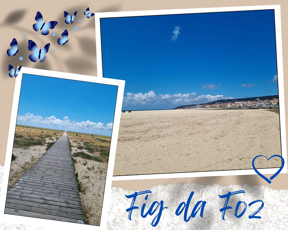
Fig Foz sits at the mouth of the Mondego River, roughly halfway between Lisbon and Porto..
The city was and still is at popular seaside city and fishing port, combining historic buildings with Art Nouveau and Art deco elements.
Fig Foz is sheltered by hills (Serra da Boa Viagem), with flat, wide beaches.
Fun facts: Foz shares its latitude with Philadelphia, Baku and Beijing. It is a legal gambling zone and home to one of the biggest casinos on the Iberian Peninsula.
We found a shopping centre, the appropriately named Foz Plaza, before heading to our ultimate destination that day. We'd both forgotten to bring sunglasses with us and we desperately needed them. Sunglasses help to stave off the glare of the white buildings and the bright light of the Atlantic and the windy beaches. It was at Foz Plaza that we discovered another mighty European retailer, Auchan, a French multinational group headquartered in Croix in northern France. Auchan is a massive general goods store and we had a ball poking around in the Foz Auchan, adding to our travelling and picnic supplies. We bought a pair of sunglasses for €25 each. They are honestly one of the best pairs I've ever owned.

I totally warmed to Fig even though we only experienced a small part of it. I loved the wide, expansive beach at Claridade and the buildings we saw seemed less shabby than in other parts of Portugal. I wasn't expecting such a contrast between Portugal's outstanding natural beauty and the rundown vibe of a lot of its buildings.
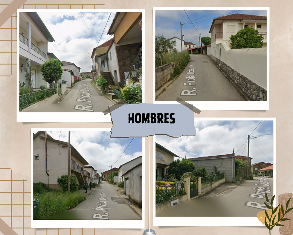
The final leg of our journey on Day 6 took us 40 kilometres inland to Coimbra (KWEEM-bruh) , where we spent the next part of our wanderings. Booking our accommodation in Coimbra on Airbnb was my first lesson in the importance of location. This is where I realised that searching for a city like Coimbra that is also a district will give up places to stay in the whole district. Staying in the rural parts of a district is completely different to staying in the cities and towns. To be fair, I chose Casa do Calhau for the description of its peaceful surroundings. It sure is peaceful! The 35 kilometres drive from Coimbra took us up into the hills northeast of the city to the municipality of Penacova into a tiny isolated settlement (Hombres) near the Alva River, a tributary of the Mondego River. The gorgeous little cottage cost us $460 for our four-night stay. Isn't it adorable? The owner even left us a cute fridge magnet! [Note that calhau means pebble or stone in Portuguese and is pronounced tsah-LYOW.]

Coimbra and surrounds ⛰️
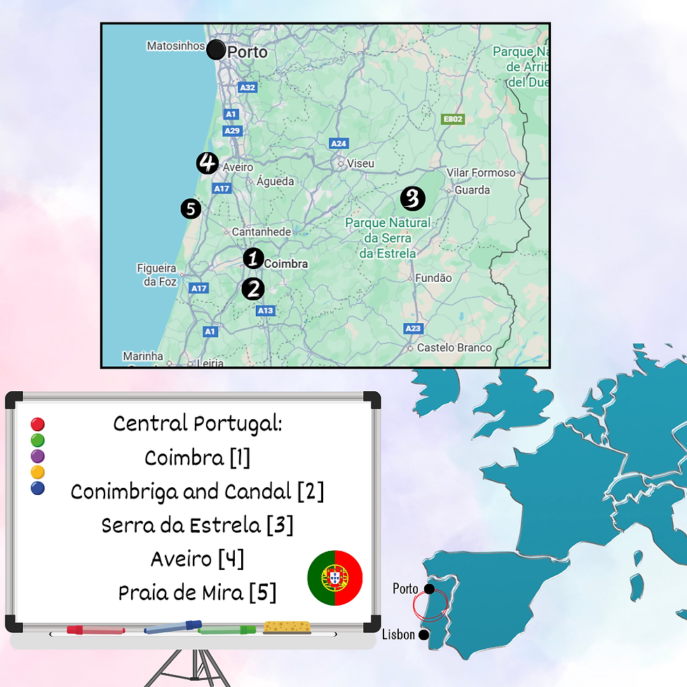
The below map shows where we spent the next part of our Portuguese adventure, staying in Coimbra and exploring some beautiful places in Central Portugal. This part of the country is essentially the bit between Lisbon and Porto.
We woke up to a cool and cloudy morning on Day 7, but decided to go for a walk to explore our surroundings. We first walked through the little village where we were staying, a rather eerie experience on a gloomy day. It is so quiet and isolated - there are no shops or services - and we didn't see a single soul. Also, our little cottage is something of an oasis in the village as a lot of the buildings are quite rundown.
We'd seen Praia Fluvial do Vimieiro (vi-mi-ei-ru) on the Alva River on Google Maps so we decided to check it out. A praia fluvial is a river beach, something unique to Europe, I think. We came to learn that they are a huge part of the Portuguese landscape. We picked our way down to the river beach, sometimes on a marked trail and other parts "wild walking".

River beaches are designated, freshwater swimming and leisure areas located along rivers, lakes, and dams.
These natural spaces are managed by local municipalities and health authorities.
They tend to be less developed than the coastal beaches, although there is usually designated parking and some basic facilities.
There was no one else around when we got down to the river. Again, such a surreal experience in the quiet. The pretty river and deep green vegetation stood out to us as well, even on a dismal morning. The landscape felt quite different here in Central Portugal to what we had experienced around Setubal. It seems much drier in the south so I expect it rains much more in the central and northern parts of the country.

We found an old watermill while we were exploring the river and a wheel driven by the Alva River's currents. Beautiful! Apparently the Penacova district, in which the river beach sits, has several traditional historic watermills (azenhas) situated along the Alva River and on local streams.

I love this photo of us! It captures the tranquility of the beautiful river so well. By this point, we were definitely completely in love with Portugal. Stunning natural spaces, devoid of other humans, are totally our jam. It was so still at the river beach that morning that it felt like we'd been transported into another dimension.

We had intended to spend the day in Coimbra but the weather was still a bit dodgy so we took a last minute detour on the highway to Aveiro (ah-VAY-roo). The city is defined by its central lagoon and has a compact, easily-walkable city centre. There are some lovely Belle Epoque, Art Nouveau, Art Deco and Estado Novo buildings and traditional Portuguese designs.

Aveiro is the provincial capital of Beira Litoral province, nestled next to a ria (a salt water lagoon) and the Vouga River delta on the Atlantic coast.
It's closer to Porto than Lisbon, around 76 kilometres from the former, and is often on traveller itineraries as a day trip from Porto.
Aveiro's origins date back to pre-Roman times, and, like a lot of Portugal at the time, was under control of the Moors from the 8th until the 11th century.
Canals and bridges intersect the city as you would imagine a lagoon city to do. The brightly painted boats (moliceiros) that tourists can now ride were originally working boats. The name derives from moliço, a type of seaweed abundant in the lagoon and once harvested to be used as fertilizer in the agricultural fields of the region.

That said, I'm not sure I agree with descriptions of Aveiro as the "Venice of Portugal". I've been to Venice. Aveiro is not it! There's a strong tourist vibe to the whole canal thing that isn't really our jam. We had a bit of a wander around and did love the architecture we saw as it was different to the traditional Portuguese whitewashed buildings. Overall, Aveiro didn't really do it for me. On the plus side, it is one of the rare flat cities in Portugal so it is infinitely walkable. No cardio stairmasters in Aveiro!
While we were near the coast we decided to check out one of the Silver Coast beaches that we randomly noticed on Google Maps. We found Praia de Mira, a half hour drive back towards Lisbon from Aveiro. It wasn't on our list of places to check out, but we headed there for lunch anyway. Sometimes the best experiences are the places you stumble across and with zero expectations.
Mira is a town and coastal municipality in the Coimbra district.
The municipality dates back hundreds of thousands of years, with administrative control handed to the various Muslim and Christian powers.
The coastal region is known for artisanal fishery, aquaculture, agriculture and fishery.
Praia de Mira is only around 40 kilometres from Coimbra so it's in a good spot in terms of access to a bigger place for shopping and services.
The beach is a little off the beaten track on a quiet stretch of the Silver Coast. The name means "beach of Mira" and, like some of the other Portuguese beaches, there is a town slightly inland and the beach is connected to it. The road into the beach is not lush like the landscapes around Coimbra, so at first I wondered what would greet us. There's a main road that leads from Mira town to the beach and first impressions of the seaside town are not great. It's definitely got the Portuguese shabby chic thing going on. That said, we loved the casual feel to the place in all its shabby glory.

Shabby bits aside, we pretty much fell in love with the place as we pulled up to the beach. The central section of beach backs onto the town with a promenade running along the seafront between giant sand dunes. The beach itself is made up of fine sand and stretches seemingly endlessly in both directions beyond Mira. Much of the coast here is backed by low lying sand dunes which have been planted with extensive pine forests to help prevent them blowing away.
Mira's lagoon is I believe one of the largest coastal lagoons in Portugal. We walked around the lagoon and along the beach for a bit and just generally took in the vibe of the place. We saw sand on the paved pathways and heavy machinery shifting the sand around, as shown in the above collection. We assumed the best was being prepared for for summer, as we imagined it must get windy from the direct Atlantic exposure.

We headed back in the Coimbra direction in the afternoon, detouring south to check out one of the schist villages in the area. There are 27 such villages in the mountains in Central Portugal. The traditional villages have recently been recovered and restored using ancient techniques. Sustainable tourism is the mantra for the redevelopment. Visitors can stay in the unique cottages and enjoy the beautiful natural surroundings. The village that we visited is nestled in the Serra da Lousa, the mountains of the Lousa area. Just look at the beautiful setting!

Schist is a medium-grade metamorphic rock formed from pre-existing rocks (like shale or mudstone) under intense heat and pressure.
Formation often stems from mountain building or tectonic plate collisions.
The rock has a distinctive foliated texture, formed of visible, parallel layers of flat, shiny minerals that allow the rock to split easily into thin flakes.
The schist villages are located in two mountain ranges, Lousa and Acor, and along the Zezere (ZEH-zeh-ruh) River and the Tejo (te-ju)-Oreza.
Candal is one of twelve schist villages in the Lousa mountains. It's 10 kilometres from the town of Lousa itself and one of the most accessible of the villages in the area as it sits adjacent to a national road. Now, this is a national road Portuguese-mountains-style, but we had no trouble getting there in our rental car. There's a short climb up to the village from the road and a small parking area, but the village's elevation adds to its magic. The village overlooks the Candal Stream (bottom left-hand photo below) and there's a chapel, a fountain and a public washing tank. Walking through the village felt like we'd stepped through the wardrobe and into a schist Narnia. Even though many of the buildings have been turned into rental accommodation, the village is faithfully preserved and it retains all its historic charm. I'm so glad we made the journey to the village, but I'd love to go back to explore the mountains further.

Day 7 was our day to explore Coimbra, the main hub of the country's central region. We braved another of Portugal's hilly urban areas to eventually find a place to park in an underground parking structure. We then trekked up yet another steep incline towards the university. Coimbra is definitely one for the cardio stairmaster!
Coimbra sits on the Mondego River. It is the fourth largest city after Lisbon, Porto and Braga.
It was first named Aeminium when it was a Roman settlement.
Coimbra was the capital city from 1131-1255. The city played a major political role in the development of Portugal, becoming a symbol of the fight for democracy and a place of enlightenment.
The university and the Alta and Sofia districts have been World Heritage Sites since 2013.
The first Portuguese university was established in Lisbon in 1290 but shifted to Coimbra in 1308, giving it the distinction of the oldest academic institution in the Portuguese-speaking world. Of course I had to check it out as a former academic! Like many of the historic universities around the globe, the University of Coimbra is woven into the fabric of the city centre. We were aware of the ancient buildings as we climbed up to its central square, but we didn't enter a distinct campus as such, or at least not like universities in Australia. I understand that the Upper University is the original and main part of the institution, but it expands further into other areas within the city landscape. There's a massive square at the top that forms the hub of the Upper University. The square is framed by a bunch of historic buildings, including the 17th century tower, a chapel, and the Paço das Escolas (School Palace). [Paco, meaning palace, is pronounced PAH-koo.]

Along the way up to the campus, we had a poke around Sé Velha de Coimbra (The Old Cathedral of Coimbra), one of the most important 12th century Romanesque buildings in Portugal. The cathedral is referred to as the "old" (velha) church as another church built in the 18th century was designated the city's second cathedral. My photos show the impressive exterior, where the the cathedral gives off fortress vibes. You can see the Gothic cloister (bottom left-hand shot), built in the 13th century.

The cathedral was constructed during the reign of Portugal's first king, Afonso Henriques. The building is characterised by its pointed arches, each with a rose window.
It is the only cathedral built during the Reconquista era - when the Christians wrested Portugal back from the Moors - that remains intact in Portugal.
The cathedral's interior is characterised by massive columns, with capitals decorated with geometric, vegetal, or animal motifs.
Sé Velha de Coimbra has an impressive interior space, awash with light and shadows. I'd begun to realise that Portuguese churches have their own style of beauty, but they seem less ornate (dare I say gaudy?) than the churches I'd seen before in other European countries. I hope my photos below give some sense of what I mean. It's remarkable that such beautiful structures were made out of stone all those years ago.

The photo below shows the tomb of Sesnando Davides, the first governor of Coimbra and a significant figure in the formation of the Kingdom of Portugal in the 11th century after the end of Moorish rule. His tomb is situated inside the cathedral near the chancel. It is such a simple stone sarcophagus for an important man, supported by carved stone lions. I understand that the restrained design symbolises respect for Sesnando as a military and political leader. It. was rather moving to stand in next to the tomb, something so old and seemingly undisturbed after such a long time.

Sesnando Davides was a Mozarab leader, a Christian who lived under Islamic rule.
Sesnando's deep knowledge of Islamic and Christian traditions was instrumental in the reconquest of Coimbra in 1064.
By all accounts, Sesnando was a brilliant administrator, city planner, and champion of inclusivity, encouraging coexistence between different religious communities.
His oversight of the city saw a huge period of growth and his strategic vision and leadership left a lasting impact on the history of Portugal.
Even if universities aren't your jam, it's worth the climb up to the centre of the campus for the views of the city and the Mondego River. I'd like to go back again, as we weren't able to visit the Biblioteca Joanina, a magnificent baroque library founded in 1717. Entrance requires a pre-purchased timed ticket.

Another of the reasons to visit the university is to wander around the Jardim Botânico da Universidade de Coimbra. The gardens sit adjacent to the square in the Upper University and are free to explore. There is obvious aesthetic value in the gardens, but they are also part of the university's research into biodiversity conservation, climate change, and sustainability. We had a lovely wander around the beautifully tended gardens, such a peaceful landscape with so few people around that morning.

The university's botanic gardens are part of the city's World Heritage Site listing.
They were founded in 1772 by the Marquis of Pombal, a Portuguese noble.
The gardens span 13 hectares and are set out in two parts. The top part is more formal, divided into upper and lower terraces. The second part is the arboretum and includes a bamboo forest and 51 species of eucalyptus.
There's also a 16th century aqueduct in the gardens, standing on the site of an ancient Roman aqueduct.
Our stroll through Coimbra took us on a loop from where we'd parked the car, up and through the university and its gardens, down to the river, and back up to our car. We only saw a small part of the historic city so I'd love to go back again. Our visit was enough to make a lasting impression, though. Walking along the river gave us the chance for a different perspective, ensuring we could properly see how high the city sits.

The below collection gives a snapshot of Coimbra's historic city centre. The church I am standing in front of in the right-hand shot was founded in 1131. Well old! The Church of the Holy Cross is a national monument and the final resting place of Alfonso Henriques, the first King of Portugal. It is another example of the Portuguese Manueline architectural style.
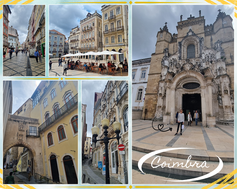
We found our car again no trouble, but discovered we needed cash to pay the parking fee on exit from the parking structure. We had to backtrack to find an ATM and withdraw some cash for an exorbitant fee. Then we had to take our large denominations and purchase a drink each to obtain some change for the parking machine. Lesson learnt!
Travel tip 🌍
One of my travel tips for Portugal is to make sure you always have some cash on you as it can often be the only form of payment.
We finished off our day in Coimbra with a visit to the Conimbriga ruins, a short 16-kilometre drive south of the city. Conimbriga is one of Europe's most significant Roman archaeological sites and one of the best preserved on the Iberian peninsula. The ruins have been traced to the House of Cantaber, the residence of a nobleman. Conimbriga is absolutely worth the €4.50 entrance fee if you are a history nerd like me.

Conimbriga was first a Celtic settlement, but was later occupied by the Romans in the 1st century, turning the site into a thriving city.
The ruins were first discovered in 1873. We now have archaeological remains of the House of Cantaber's opulent villa, its bathing complex and sophisticated heating system, and the ornamental pools and columnated gardens.
There are also ruins of temples, a forum, an aqueduct, water conduits, drains, and elaborate piping systems that heated the city's public and private bathrooms.
For a little extra history, the Romans arrived in what we know today as Portugal around 218 BCE, adding the region to the Roman province of Lusitania. Roman rule spanned 600 years, during which time roads, cities, temples and aqueducts were built.
The mosaics on the site are what stood out to me. They are incredibly well preserved and in such good condition for their age. The mosaics show intricate detail and colourful designs that include motifs of beasts, hunting scenes, and mythological themes. One of the mosaics shows Perseus offering Medusa's head to a monster from the deep. Conimbriga is gold for history lovers. I don't think I've ever seen anything quite like it.

Conimbriga, with around 10 000 inhabitants, was not Portugal’s largest Roman city, but today is one of the best preserved. The ruins are one of the most significant sites to tell us what Roman Portugal was like, even if only around one tenth of the area has been excavated. The complex is quite extensive, so it takes a bit of time to wander around. There's also a small museum that provides further insight into life in the town in Roman times. In true understated Portuguese style, there is a small gift shop at the complex.

Day 8 of our Portuguese adventure and our final one in Coimbra saw us explore for the first time the mighty mountain range of Serra da Estrela (mountain of the stars). Estrela (es-tray-luh) is the highest mountain range on mainland Portugal. Note that the highest mountain the country is Mount Pico, located in the Azores (ah-SOO-resh) islands.
Below is a reminder of Estrela's location. The mountains are in inland central Portugal, not far from the Spanish border. Estrela is a good 300 kilometres from Lisbon and around 190 kilometres from Porto.
The highest point of Estrela is 1993 metres at theTorre (tower).
The mountains were created by a huge granite ridge that once formed the southern frontier of Portugal.
Three rivers have their headwaters in Estrela: the Mondego, the Zezere (a tributary of the Tagus), and the Alva.
The mountain range is 100 km long and 30 km wide, with 375 km of marked hiking trails.
Estrela is one of the rare global high mountain ranges that is accessible by road right to the top. The below shots give an idea of what the roads are like. We only hired a medium-sized car and had no trouble driving up to there. There are some places where things are a little hairy, in true Portuguese style, though, as the below bottom left-hand photo shows. There is no public transport up the mountain so the options for getting there are either a rental vehicle or a guided tour.

Heading east from Coimbra in the morning we made a pit stop at the pretty mountain city of Seia, on the northwestern slopes of Estrela. It wasn't long before we were treated to magnificent views as we climbed to the top of the mountain. Portugal's natural beauty was well on display that day!

It was May when we visited and we were NOT expecting to see any snow, but we spotted some the closer we came to the summit. The below photos were taken a few hundred metres from the top. Driving along and suddenly spotting some snow was such a bonus. We just had to get out of the car and have a poke around. We live in a hot and humid part of Australia so snow is such a novelty. We were so excited to see some that day!
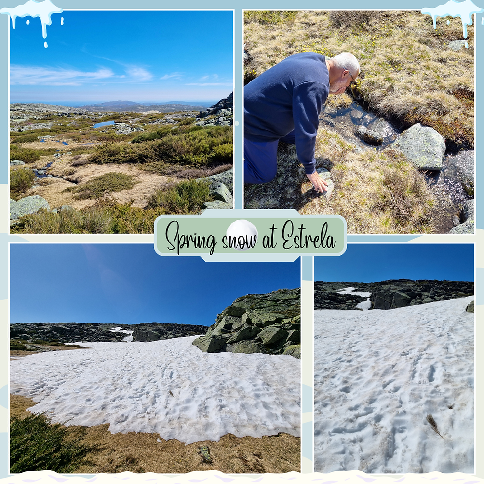
I wrote above that Estrela is 1993 metres high at Torre. The top of the mountain is not so much a distinctive mountain summit, but rather the highest point of the Torre plateau. We arrived at the tower and easily found a parking place as the car park at the summit was virtually empty. Granted, it was a week day. I also imagine only the motivated visitors make it to Estrela as it's not all that accessible from Lisbon or Porto without your own transport and time on your side.

I will admit that the summit itself is a bit disappointing given what I assume would be a popular place during winter when the ski resort is open. The only structures at the top are shown in the two right-hand photos in the above collection. There are two odd geodesic domed buildings that were once radar towers for the Portuguese Air Force. The monument to mark the highest point of mainland Portugal seems to serve mostly as a roundabout for cars. The white building that sits between the two domed buildings houses a small cafe, gift shop and rest room, but it's all a bit run down. That's the charm of Portugal, but it might not be everyone's jam. We had a picnic lunch with us so the basic facilities didn't bother us. There is a loo, and that's all I need!
The little gift shop is hilarious, actually. We were its only customers that morning. The whole place smelled like cheese and wet wool. I bought the most adorable mementos of our day out there from a super friendly guy behind the counter who seemed desperate for us to buy some local cheese.

Local Estrela produce
There is a breed of livestock guardian dog that takes its name from the mountains. The name is Cão da Serra da Estrela in Portuguese, meaning the Estrela mountain dog. Cão is pronounced s-oun.
The mountains are known for their soft cheese (queijo Serra da Estrela), made from cardoon thistle, raw sheep's milk, and salt, from a 2000-year-old recipe. The region's ancient bordaleira sheep's wool is also prized. Queijo (cheese) is pronounced KAY-zhoo.
I absolutely love mountains so our day out in Estrela was one of the highlights of our trip. Mountains to me are such a vital reminder of the beauty and majesty of nature and being up so high gives such perspective. Estrela is full of boulders, deep valleys and glacial lakes and its accessibility is such a bonus. I'd like to go back and do some hiking and visit some more of the villages that are part of the mountain range.

Our Estrela experience was all rather surreal as there was hardly anyone around. We found a picnic spot for lunch that afforded stunning views of the mountains and sat and ate our lunch, absorbing the quiet. I've always found peace in nature but this trip to Portugal truly cemented for me how beautiful (and serene) natural landscapes make me feel at ease. The only thing to interrupt our peace was a random herd of goats. We heard their bells clanging and sat and watched as they passed us by. So cool!

Another of the magnificent sights near the summit is the Comprida Dam (Lagoa Comprida). Estrela is home to a hydroelectric system of dams from the three rivers that have their headwaters in the mountains. We stopped at the Miradouro da Lagoa Comprida (lookout) and walked along a section of the dam walls. There are hikes from the dam that take you to the mountain lakes, including the popular Cova dos Conchos, the bell-shaped spillway. The other side of the dam has a little shop that sells Estrela products. [Note that the spillway is pronounced co-VAWN doosh CON-shoosh.)

Comprida Dam sits at 1600 metres, first constructed in 1912 from an ancient glacial lagoon, and later expanded in 1934 and 1966.
It serves as a vital hydroelectric power source as the largest water reservoir in the Estrela system.
There is usually 12-14 million cubic metres of water in the dam.
The structures is 28 metres high, 130 metres wide, and 2500 metres long.
The mountain road runs right alongside the dam on the bottom western side, as shown in the below photo. We were completely blown away by the sight of the dam as it loomed ahead of us on our drive up to Torre. My photos only go some way to capturing the magnificent dam and how stunningly peaceful it looked that day. And how about that view! We literally felt on top of the world!

At this point we were still getting used to figuring out how to find hiking trails in Portugal. We thought we had located the hike we wanted to do, but got a bit lost, ending up in a little mountain village. That said, I needed to use the toilet just then and we randomly found a facility in what looked like a residential dwelling. It was super clean, complete with mop and bucket sitting behind the door. Portugal's buildings might seem neglected, but every public restroom we used was sparkling clean. Anyhoo, we finally found a place for a stroll, by the River Alva. So pretty!

Our walk took us past the Sabugueiro Hydro Power Plant that has been in operation since 1947. The plant is operated by EDP Global to harness the glacial waters of the Alva. It has three generating units with an installed capacity of 12.8 megawatts. I am not sure what this means technically, but the plant's surroundings are stunning.

The day turned beautifully warm and sunny and we loved our stroll that afternoon. There is a path to follow but it wasn't marked and at one point I wondered if we might be lost. Winging it seemed to work and we managed to find our way back to the car. We later mastered the art of using All Trails or Kamoot to find hikes, but it can be challenging in Portugal with the lack of clear markings.

I took a shedload of photos that day. Estrela is a photographer's dream! I've put together one final collection of shots from our day in the mountains, capturing the beauty and diversity of the landscapes.

So that was it for our Coimbra sojourn! Our four nights in the cottage gave us the chance to experience something of the historic city and explore its surrounds. We'd seen such diverse places and spaces: an ancient university, Roman ruins, a stunning Silver Coast beach, and the magnificent Estrela mountains.
Casa do Calhau has been beautifully renovated and it was perfect for us for a short stay. We'd loved the peaceful location although it was a rather surreal experience to stay in the tiny village with no shops and no humans. (I mean, I'm sure they were around; we just didn't see any...)
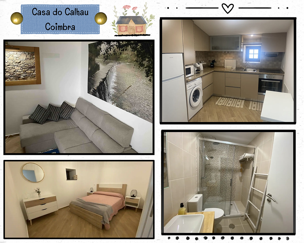
I'll finish this part of our Portugal adventure with two mementos of our Coimbra stay, both purchased at the gift stop at the university. That's me with our daughter, E, in Brisbane, wearing the t-shirt I bought.

Porto🍷
Our journey from Coimbra to Northern Portugal took us some 220 kilometres, to the Peneda-Geres National Park where we stayed for five nights. Porto sits about halfway between the beginning and end of our journey on Day 9. We spent the day in Portugal's second largest city before heading to the cottage we had rented in Peneda-Geres (peh-NEH-dah zheh-RESH).

Porto, a city continuously inhabited since the 4th century BCE, is built at a high point overlooking the Douro estuary's northern side.
Its historical centre was declared a UNESCO World Heritage Site in 1996.
The city was originally named Portus Cale by the Romans in the first century, a name that eventually evolved into Portugal.
Porto later officially became A muito nobre, sempre leal e invicta cidade do Porto, translated as The very noble, always loyal and undefeated city of the harbour.
Locals shortened the name to Oporto, the o being the Portuguese article "the" (as in "the harbour"), but nowadays the English name without the article is used.
There are three distinct areas in the central part of Porto: (i) the Ribeira riverfront, (ii) Vila Nova de Gaia, the port wine district on the other side of the river, and (iii) the old town (city centre).
Porto is famous for its sweeping views of the Douro (doh-ROO) River, historic architecture, and the birthplace of port wine. I felt a strong connection to the city as soon as we drove in. I remember feeling so excited to be there as we found a metered car park on the side of the hilly old town. Porto is every bit as beautiful as it is portrayed in all its Instragram glory. I understand the city escaped much of the devastation caused by the 1755 earthquake and today, Porto is filled with medieval and modern buildings and a tangle of red-roofed houses cascading down to the slopes of the old city.

There are loads of historic buildings and churches to visit, but we preferred just to take everything in as we walked around, especially since it was a lovely hot day and the place was buzzing with people. That's me in the top left-hand photo, standing in front of the 12th century Romanesque cathedral. We didn't have the chance to go inside - next time! - but I believe that the cathedral's tower and cloisters are worth a visit.
The one thing that I wanted to do while we were in Porto was experience the Livraria Lello, commonly regarded as one of the world's most beautiful bookstores. My usual planning failed me this time as I didn't realise the bookshop (i) would be so busy, and (ii) would require a ticket. We arrived to find a LONG line so we hastily went to the Lello Bookstore website and purchased our timed entry tickets for later that morning.

Livraria Lello opened in 1869; th current bookstore in 1906. The Neo-Gothic exterior shows the original name, Lello and Irmao.
The ceiling and interiors are decorated with painted plaster to resemble sculpted wood, with pointed arches and intricate Gothic designs.
The crimson Art Nouveau staircase is the store's main focal point, along with the beautiful stained glass ceiling panels.
The original wooden tracks and carts remain, once used to move the books between shelves.
I would one day love to return to take in the magnificent bookstore on a less busy day. My photos in the above and below collections give some idea of just how crowded it was that day. I know were only adding to the crowds, but it's quite hard to appreciate the bookstore when jostling for space with so many other people. I still 100% agree that it is a beautiful bookshop!

I didn't buy a book before we left, but instead opted for the notebook and bookmark. I wanted something to remember the architecture by, in all its Neo-Gothic and Art Nouveau glory. As a book nerd, I was in heaven, and I wouldn't have missed seeing the bookshop for the world, despite being completely overwhelmed by the crowds.

Travel tip 🌍
The bookshop is super busy during the day, so you must buy a timed entry tickets if you don't want to miss seeing inside. The silver ticket is €12 at the time of writing, including a discount on a book purchase. The lines are long, but there seems to be an efficient system to move people through. Livraria Lello's owners began charging to go inside in 2015 and I understand that up to one million people visit the store each year.
I have a thing for beautiful European train stations. Porto's Sao Bento is up there with the best I have seen. The main hall is a magnificent canvas of Portuguese tile work. The station is a hub of regional train services and it is linked to the Sao Bento station on line D of the Poro metro system.

Sao Bento station is located in the heart of the old city, built on the site of a former Benedictine convent, constructed between 1904 and 1916.
The main hall of the station is decorated with Portuguese blue and white glazed ceramic tiles (azulejo). There are some 20 000 plus tiles created by artist Jorge Colaco, covering 500 square metres.
The murals represent Portuguese history and folk scenes from the Douro region.
One of Porto's main features is the iconic Dom Luis I bridge that connects both sides of the river. The lower deck is used today by buses, taxis, cyclists and pedestrians and links to the Ribeira and Vila Nova de Gaia waterfronts. The upper deck is used by pedestrians and Line D of the Porto metro, connecting the old city to the Serra do Pilar Monastery in Vila Nova de Gaia.
We walked across from the city centre to Vila Nova de Gaia on the lower deck and back across on the upper. The monastery st Vila Nova de Gaia can be seen in the background of the above top left-hand shot.

The bridge is a two-hinged double-deck metal arched bridge, built between 1881 and 1886.
The bridge was designed by Theophile Seyrig, a disciple of Gustav Eiffel (yes, that Eiffel!). Eiffel pitched for a single-deck bridge in 1879, but the pitch was rejected by the Portuguese government. A competition was launched for a double-deck design, won by The Belgian Societe de Willebroek.
The bridge has a length of 385 metres and a height of 45 metres. The bridge's width is 8 metres.
Our afternoon walk took us down to the waterfront on the old city side, across the bridge on the lower deck then up to the Serra do Pilar Monastery. So much walking up and down hills that day! The below shots provide fantastic views of the bridge from the Gaia side and of the Ribeiro waterfront.

It is a hike up to the monastery once making it to the Gaia side of the river, but well worth it for the views. The monastery sits on an outcrop overlooking the bridge so it's perfect for views. I recommend braving the steep climb as the perspective of Porto from up there is absolutely wonderful.

The circular monastery and its cloisters date back to the late 16th century, influenced by Renaissance design.
The monastery was constructed by the Order of St Augustine.
The 36-metre-tall church and its bell tower dominate the skyline on the southern bank of the Douro.
The monastery was designated a UNESCO World Heritage Site in 1996.
Walking back from Gaia to the old city to find our car again gave us another opportunity to take in the beautiful views. The bridge is definitely one of the best places to appreciate Porto. Our love for Porto was helped by the magnificent weather that day, too.

The Ribeiro (rri-BEI-ru) riverfront is infinitely Instagrammable and thus super popular with tourists. There's a promenade loaded with restaurants and cafes, sitting in front of narrow cobblestones paths lined with colourful historic buildings. The below top right-hand photo shows how busy it was on the day we visited, so we preferred to take in the views of Ribeiro from the bridge.

Porto is a beautiful and unique city, but it's geography, like a lot of Portugal, is tough to travail. All those hills and cobblestoned streets! The ground is quite uneven as the Romans strategically built their fortified settlement into a cliff face overlooking the river. There is a funicular and cable car, but we walked the whole day, up and down the stairs that are cut into the stone on the cliff face and back and forth across the Dom Luis Bridge.

I would return in a heartbeat, as Porto now counts among my favourite European cities. There's something magical about its hilly location on the pretty river, the mighty bridge, and all the colourful ancient buildings and cobblestone paths.

On our way to our eventual resting place for the next five nights we stopped off at Foz do Douro, a beach on the northwestern side of the city, and one of Porto's most affluent areas. It is possible to get a tram out there, but I imagine most visitors stick with Porto itself. The beach is a wild place, facing off against the mighty Atlantic at the mouth of the Douro. The Felgueiras Lighthouse, constructed in 1886, sits on the massive jetty on the right bank of the Douro. I love lighthouses, standing as sentinels to guide sailors into port.

Our most vivid memory of our Foz do Douro wander, though, was the ice cream we bought from a mobile vendor. Each cone seemed to be its own entity that had to be rendered into soft serve. The woman who served us dispensed the ice cream from a machine that required her to put her whole body into it and pull as hard as possible in a twisting motion to "soft serve" the original item and fill up the cone. I wish I'd captured the moment as we'd never seen anything like it before!
Northern Portugal ⛰️🐓
After leaving Porto we drove around 100 kilometres inland to the cottage we had rented in the Peneda-Geres National Park. Our plan was to spend the third part of our trip getting a feel for Northern Portugal. I'd searched for a place to rent in the Braga district. I chose a cottage in the national park and, like our Coimbra stay, we had quite the trek to find the place. Staying outside of the main urban areas seems to mean being in the middle of nowhere! I also learnt that x kilometres might sound like a short distance, but it's not the kilometres so much as the windy, hilly journey. All that said, our isolated Coimbra and Geres cottages were just lovely.

Le Geres lies deep into the national park, with a half hour or so windy journey once veering off the highway. Christine and her husband own the cottage and they live with their children in the adjoining house. The photo along the bottom of the below collection gives an idea of the set up (also, the arrows point to the cottage). The white building is Christine and her family's home. The top shot shows me standing on the gravel driveway where we parked our car, in front of the family's lodgings. The beautiful cottage cost us $580 for five nights. Absolutely worth every penny!

Christine greeted us when we arrived and we saw her out walking her dog or in the garden most days as we left or returned to the cottage. We waved to Christine's husband once but didn't see or hear the family otherwise. What a fascinating life they lead, in the middle of a national park! Oh, and Christine is French and doesn't speak much English so I had the chance to practise my limited French. I was delighted to be able to get by (just!).

Yes, it is a trek to get to and yes, there is nothing much around other than a mini market a few minutes' drive away, but I absolutely fell in love with the stone cottage at Geres. I have a thing for stone cottages and it is my dream to live in one. Christine has done a lovely job with the renovations and the cottage is spacious and clean, the perfect size for the two of us to live in!

One of my favourite rooms in the cottage is the bathroom. The below right-hand shot shows the unobstructed view of the national park from the shower. The other two photos show the bathroom design. I don't think I've ever had a shower with a view like that before!

Day 10 of our Portugal adventure didn't start off so well weather-wise as it was cool and cloudy. We decided to check out the praia fluvial (river beach) down the hill from the cottage first up. The landscape is so green and lush and we had lots of fun picking our way through the giant flat sones near the river. It was quite a climb back up to the cottage, along the loose stone pathway seen in the below bottom left-hand shot.

It was at the river beach that I took this photo of us. I am rubbish at selfies! And I never know what to do with my face in posed photos, so I am thrilled with this one. It's such a lovely shot of us with a stunning example of the Geres landscape behind us.

We headed out for the day mid-morning, to check out the section of the coast north of Porto towards the Spanish border. Looking back now, I can see that we were suffering from travel fatigue and that affected our impressions of what we saw that day. We just weren't feeling it that day. This kind of feeling is symptomatic of my felt need to pack as much in as possible. It's something common to Australian travellers, I think. Our place at the bottom of the world means that travel to Europe is costly and involves a long journey, usually two flights. In hindsight we probably should have had a rest day, or just stayed near the cottage and explored the national park.
Anyhoo, we drove to the coast - about an hour and a half's drive - to our first stop at Praia de Ancora, a small beach town in the Caminha municipality. It is one of the most northern beaches in Portugal and only a short distance from Spain. The town sits at the end of the valley of the Ancora River, between the foothills of two mountain ranges. The flat, sandy beach is bounded by a breakwater of a small fishing harbour and divided in two by the river.

I have to admit that we didn't instantly connect with Praia de Ancora the way we had done with Mira. The town was quite lovely, but the beach didn't steal our hearts like Mira had done. We didn't linger but instead drove up to a hill overlooking the town for a picnic lunch with a view. It does look lovely, so I am not really sure why we didn't quite vibe with the place. The town is bigger than Mira but the beach not as picturesque for walking. Also, Mira is isolated, but Praia de Ancora felt even more so.

We drove a further 40 kilometres south after lunch, to Viana do Castelo, the next coastal town. To give a sense of perspective, the town is still close to the Spanish border but only 150 kilometres from Porto. The weather had turned cloudy and cool and we didn't feel motivated to explore the town, even though it is often regarded as one of the most beautiful in Portugal. Driving in, it didn't seem that way to us. So instead, we drove up to the Santa Luzia Sanctuary for views of the mouth of the Lima River. The church is worth the effort for the views, even if it was cloudy when we were there. I also loved the massive round window on the front facade, like a giant flower.

Santa Luzia is a 20th century basilica on the hill overlooking Viana do Castelo, built in neo-Byzantine style.
The basilica has a magnificent giant rose window on the front facade, the largest on the Iberian Peninsula.
A funicular provides access from the town or you can climb the 660 steps to get the the top.
It's free to see inside the cathedral although there is a small fee to climb to the viewing platform at the top of the dome. There's also a cafe and gift shop.
We couldn't see inside the cathedral as there was a wedding on that afternoon, so we headed off and found a cool sports store on our way of town. Despite the language barriers we managed to buy a pair of joggers each and for me a light waterproof jacket that I wear all the time now.
Our final stop before heading back to the cottage saw us at Esposende, another of the coastal towns north of Porto, but within the Braga district. Again, we didn't vibe with the place, but as I noted above, I think we were just fatigued that day. [Note that Esposende is pronounced esh-poh-ZEN-deh.]

Unfortunately I woke up on Day 11 feeling wretched, with griping pains in my stomach. We were determined to make the most of the day, though, so we headed an hour south in the morning to Guimaraes (gi-mah-RY-iz), south of Braga. We had a lovely wander around the town in the warm and sunny spring morning, even though I felt a bit rubbish. Guimaraes really is a beautiful place, so leafy and green. There is a cable car for accessing Mount Penha for views and hiking trails, but I wasn't up for any of that when we were there. We also needed to allow time to to explore the Douro Valley in the afternoon.
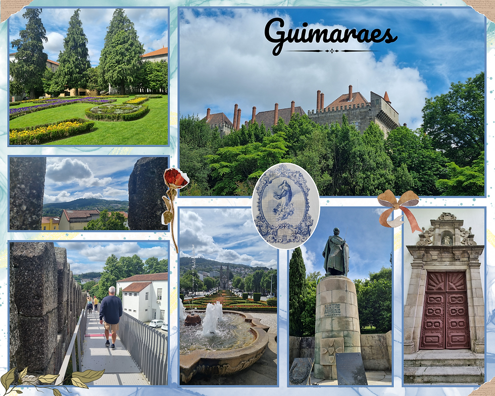
Guimaraes has been a UNESCO World Heritage Site since 2001.
The city is historically significant, commonly known as Cidade Berco. This means cradle city, referring to the birthplace of Portugal. There's an old inscription on the city's walls: Aqui nasceu Portugal (Portugal was born here).
The country's first king, Afonso Henriques, was born in Guimaraes in 1106. The Battle of Sao Mamede, fought near the city in 1128, is considered key to the foundation of the Kingdom of Portugal.
There are loads of medieval buildings in the historic centre, but the castle is one of the main features of the city. It was built in the 10th century by order of the Mumadona Dias, a Galician noble and Countess of Portugal, to defend Guimaraes Monastery from attacks by the Moors and Vikings. The medieval castle stands proudly on a granite hill surrounded by a lovely small forest park and provides beautiful views of the city. There's not a lot to see in the castle as most of the original has been lost, but it is only €5 to enter.

Our picnic lunch stop was in Amarante, another beautiful town in Northern Portugal, a short drive further south from Guimaraes. Even though we only stayed to eat our lunch, I think the town is absolutely stunning. It's small and there's not a lot to explore, so I think it is mainly visited as a day trip from Porto, along with Guimaraes, or as a gateway to the Douro. The river setting for our picnic lunch across from the old bridge was so lovely. I was so taken by Amarante (ah-mah-RAHN-tay) that we returned the following year and stayed for a few days, using the town as a base for further exploration of Northern Portugal.

Amarante sits on the Tamega River and dates back to the Iron Age.
The bridge and church seen in the top photo above are dedicated to Saint Goncalo, a 16th century priest and the patron saint of love.
The 18th century bridge famously defended the town against Napoleonic troops. The city's resistance earned it the Order of the Tower and Sword, now on the town's coat of arms. Battle scars remain: cannon damage to the church's façade, perforated tiles in its sacristy, and marks on the bridge itself.
I had planned our day to ensure we could experience some of the Douro Valley, a UNESCO World Heritage Site and the world's oldest demarcated wine region. I am not a wine drinker, but the valley is absolutely worth exploring. The region is around 100 kilometres east of Porto and it takes some getting there, plus there's a lot of ground to cover. We chose to focus on a small part around Pinhao (pee-NYOW). The region is known for its steep terraced vineyards that have been carved into the hills by centuries of agriculture and farming. We were mesmerised by the scenery as we climbed up the hills and stopped to appreciate the views.

The valley flanks the mighty Douro River, the largest river by discharge of the Iberian Peninsula. The river stretches just under 900 kilometres from central Spain to the Atlantic Ocean at Porto, the city sitting on its mouth. The river weaves its way through the terraced vineyards in Northern Portugal, marking out the heartland of Portuguese wine production and serving as a hotspot for river cruising.

I was so relieved to be feeling better on Day 12 as we still had Braga to explore. Our first stop that morning was at the Sanctuary of Bom Jesus do Monte (Good Jesus of the Mount), a Catholic shrine and pilgrimage site on Mount Espinho overlooking the city. Braga is recognised as the heart of Iberian Christianity and the sanctuary is a major historical monument in Portugal.
It's worth the trek up the mountain for the views alone, the expansive western-facing site providing panoramic views of Braga and the surrounding mountains. We were so fortunate to have a cool but gloriously sunny day to visit.

Bom Jesus do Monte was originally founded in 1373, a chapel later rebuilt in the 15th and 16th centuries.
The site was further enhanced in 1722, under the patronage of the Archbishop of Braga, Rodrigo de Moura Telles. The abandoned Holy Cross chapel was reborn. Construction of the magnificent stairways seen today began.
Construction began in 1784 on the present-day Neoclassical basilica. A water-powered funicular was installed in 1882, linking the sanctuary to Braga.
Travel tip 🌍
It is possible to drive, as we did, to the foot of the staircases leading up to the basilica, although there isn't a lot of parking. There are 573 steps up to the basilica from its base. There is a funicular at the base for a cost at time of writing of €3 that takes three minutes to reach the top.
The below collection is a nice summary of the whole sanctuary that was given UNESCO World Heritage status in 2019. You can see something of the gardens, the views, and the basilica. The most enduring images of the Bom Jesus do Monte are the staircases up to the basilica, shown in the top left-hand and bottom right-hand shots. The stairs are not only a gateway to the basilica, but represent a pilgrimmage, with three symbolic sections.

The stairways
The Portico Staircase (376 steps): Represents the Via Crucis (Way of the Cross). The path is punctuated with chapels commemorating the Passion of Christ, replicating the path that Jesus is said to have taken to his crucifixion (the Via Dolorosa in Jerusalem).
The Stairway of the Five Senses (104 steps): Split into two symmetrical zigzagging stairways, where the five senses are represented by allegorical fountains.
The Three Theological Virtues (93 steps), dedicated to faith, hope, and charity.

The sanctuary is free to explore, as is the interior of the basilica. The vaulted ceiling is huge, and there are ornate walls in colours of ivory, pink, baby blue and gold. The back altar represents the Crucifixion.

We had a full day planned to explore Braga and nearby Barcelos, so we didn't have time to see all of the sanctuary. The sanctuary is essentially a giant park, and there are several small chapels, gardens, caves, and a lake to explore in addition to the basilica and the staircases. The inevitable gift shop stocks mementos of the sanctuary and of Braga and its surrounds.

Braga itself is a stunning city and feels much less rundown than Lisbon. It also has the honour of being one of the few flat urban areas in Portugal so it's easy to walk around. The day had warmed up by the time we left Bom Jesus do Monte and found a park in the centre of the city. We didn't go inside any of the buildings, but were happy to stroll around Braga and take it all in. I expect there are fewer visitors to Northern Portugal as Lisbon and Porto are the main tourist draws. It was rather nice to wander around without battling crowds of people.

Braga is Portugal's third largest city after Lisbon and Porto and the heart of Northern Portugal.
Human occupation of the region goes back to the Megalithic era (9000 BCE to 12 000 BCE).
The city was known as Bracara Augusta during Roman times. It was the capital of the first kingdoms to separate from the Roman Empire in the 5th century.
The city held a prominent place in medieval politics and in Portugal's independence from its Moorish conquerors.
Portugal is all about the blue! The Palacio do Raio (puh-LAH-syoo doo RYE-oo) is a magnificent example of the blue tile work that is found throughout the country. It is possible to see inside the building, now a museum, for a small fee. Unfortunately we were in Braga on a Monday and the museum is closed then (and on Sundays). Still, it was enough for us to admire the beautiful building from the outside.

Palacio do Raio is a Baroque and early Rococo-style residence with a distinct granite and blue tiled exterior.
The building was designed by architect Andre Soares in 1754.
Construction was ordered by João Duarte de Faria, a knight of the Military Order of Christ (the former Knights Templar) and a rich merchant.
The name means Palace of the Lightning.
The blue azulejo tiles were added in the 19th century, transforming the building's exterior.
The remainder of our day was spent in Barcelos (bar-SEH-loosh), a 30 kilometre drive west of Braga towards the coast. I loved Barcelos! Its historic centre is compact, flat and full of narrow streets, squares and historic buildings. Barcelos holds an important place in Portuguese folklore. The city is the place of origin of the rooster, a cultural symbol of Portugal found all over the country. Below is the most widely-accepted Rooster Origin Story.
A Galician pilgrim on his way to Santiago de Compostela* was wrongly accused of a crime and condemned to hang. Prior to his execution the pilgrim asked to be taken to the judge who had sentenced him. The judge was dining with friends. The pilgrim declared that his innocence would be proven if a roasted rooster on the table crowed. The bird miraculously stood up and crowed as the pilgrim was about to be hanged. The judge rushed to the gallows and found that the knot had not yet tightened on the noose, saving the pilgrim’s life and freeing him.
🐓🐓🐓🐓🐓🐓🐓🐓
*The Santiago de Compostela is the final destination on the Way of St James that stretches through France, Spain and Portugal. You may of heard the Way referred to as the Camino de Santiago, one of the most well-known hikes in the world. The route is a network of pilgrimages leading to the shrine of the Apostle James in the cathedral of the Santiago de Compostela in Galicia, in north-western Spain.
The below photos show the ruins of the Palace of the Counts of Barcelos. The palace sits on one side of the Cavado River overlooking the medieval bridge that connects its banks. The arched bridge was built in 1325, by order of one of the Counts.

The palace was built in Gothic-style in the first half of the 15th century by order of the Eighth Count of Barcelos.
It was heavily damaged by the 1755 earthquake.
The site is now an open-air archeological museum.
The stone cross that the pilgrim erected to represent divine providence, from the Legend of the Rooster, is part of the ruins.
Adjacent to the palace is the Church of Santa Maria Maior, built in the second half of the 14th century, blending its Romanesque structure with Gothic accents and Baroque decor. The old church still looks sturdy and it's another example of the architectural simplicity of the churches we'd seen on our travels.

The below photos are a snapshot of Barcelos's pretty historic centre, flanked by the Jardim das Barrocas, a colourful garden with manicured beds, patterned pathways, and well-kept hedges.
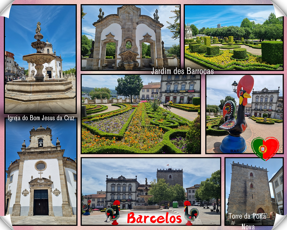
Below are some more photos of the town and the rooster fridge magnet I just had to buy to remember Portugal by. We stopped in one of the narrow paved streets for a delicious ice cream that we had to consume before the warm afternoon sun melted it.

Day 13 was to be our final day in Portugal. We decided to return to Praia de Mira for a picnic lunch, cementing our first impressions of the tiny coastal town as our favourite place. There is not much to the town and the whole place has a slightly decrepit feel to it, but there's just something about the beach and the lagoon that speaks to us.
Returning to the cottage one last time gave us the chance to take in the beauty of the Peneda-Geres National Park. We only saw a small part of the park, but it left a lasting impression on us. The scenery is magnificent!

Peneda-Geres was created in 1971. It is the oldest protected area in Portugal and the country’s only national park, covering 696 square kilometres.
The park sits at the northern tip of Portugal, bordered by the Baixa Limia-Serra do Dures Natural Park in Spain. The two form the UNESCO biosphere reserve, Geres-Xures.
Serra da Peneda and Serra do Geres, two of the park’s massifs and its highest peaks, form its name. A massif is a main mountain mass containing one or more summits.
Here are our last glimpses of Portugal as we headed back to Madrid to fly back to Australia. I'm never happy to face the prospect of the long journey back to Australia from Europe, but that's the price paid when living at the bottom of the world. We left Geres, staying in Zamora overnight to break the journey to Madrid. You can read about our Spanish bookends to Portugal here.

Adeus, Portugal (tristemente) 😔
We'd had such an awesome first expedition to Portugal so we departed Madrid with sadness but with our hearts full. Our flight left Madrid at 9.30am on Friday, 31 May and arrived back in Brisbane on Saturday, 1 June at 5.30pm. That meant a 7-hour flight to Doha with a few hours layover then a 14-hour flight from Doha to Brisbane. It's always brutal, especially coming back! Being able to use my gold membership with Qatar Airways for the lounge and priority boarding, and my points for the leg room seats, made the horrendous journey slightly more bearable. Adeus, Portugal, ate a proxima!

Our 2024 experience of Portugal will always be the most special as we were discovering the country for the first time. We were learning to understand and appreciate the dichotomy of Portugal's natural beauty and the air of decay and abandonment of many of its buildings and structures. We came away with a strong connection to the country and it feels like home now in ways that are difficult to describe.

Our first trip alone together in 16 years: The chance to experience something special just the two of us and rediscover how to be just us.
Discovering that Portugal was totally our vibe and loving it more than we expected to. The country's warmth enveloped us.
Navigating our way around cities, towns, rural areas, and mountains and feeling pretty chuffed at our achievement.
The many opportunities to spend time in wondrous natural spaces, something that feeds my soul and makes me feel at peace.
I have so many vivid and lasting impressions of that first visit to Portugal. The country's natural beauty is its drawcard, as is the diversity of the landscapes. The places that are still upmost in my mind are the mountains at Estrela, Peneda-Geres National Park, the (often super windy) beaches, and the Douro wine valley. I learnt to appreciate Portugal's architecture in all its shabby glory. Experiences that stood out to me were navigating ancient castle walls, marvelling at the intricate design of the Livraria Lello and the Convento de Christo, walking across the impressive Dom Luis I bridge in Porto. Also, just the age of the place! So much history! Below are more of my most vivid and lasting impressions of Portugal and its unique brand of living:

Portugal's no f**ks given attitude to safety. Wild. I will never forget walking along the precarious Obidos walls.
A beach (in the Arrabida) that requires scrambling down unstable cliffs. Also wild.
The cardio stairmaster that is much of Portugal. So many hills and steps!
Whipper snippers for mowing grass.
Gorgeous stone cottages in the middle of nowhere.
Cheap and high-quality fresh produce from fascinating supermarkets.
Our first Portugal wanderings inspired our love of the country and our desire to return. Check out the posts on our other Portugal wanderings (to come). I hope our expeditions have inspired you to visit Portugal and experience its natural beauty for yourself. Nos amamos-te, Portugal 💖.

Comments