Our winter Portuguese expedition

A little bit of background 📝
Our Portuguese winter wanderings took place in February 2025, building on our first expedition the previous May. Portugal is a country in which we are thinking about spending blocks of time in the next chapter of our lives. We’d fallen in love with Portugal almost immediately during our first trip. It’s such a beautiful place, with an air of authenticity and warmth that we related to from the outset. We planned our second trip for winter so we could experience the weather at that time of year and vibe-check the place again to confirm our initial feelings.

Our Portuguese winter wanderings were again bookended by a little bit of Spain. We used air miles to fly again with Qatar Airways, taking advantage of the membership points to secure leg room seats and lounge passes. Qatar Airways is a top-notch carrier, I think, but unfortunately, it’s not easy to get to Lisbon from Brisbane. So...we had another go at flying in and out of Madrid and hiring car to drive to Portugal. You can read more about our journey to Madrid and our drive across Spain into Portugal here.

I’ve made a map that shows the routes we took into Portugal from Madrid, in May 2024 and again in February 2025. Our first journey took us southwest from Madrid to overnight in Talavera de la Reina and into Portugal at Evora via Badajoz. This time, we drove further on from Madrid, to Plasencia near the border, crossing into Portugal at Castelo Branco, before our reaching our eventual destination, Caldas da Rainha. We returned to Madrid on that second trip from Amarante in Northern Portugal via Salamanca and Avila. You can read all about our second Spanish bookends experience here. Was it a bit of a hassle to fly in and out of Madrid? Absolutely! But what an added bonus it was, to experience something of Spain.

This post is all about our winter expedition to Portugal. We spent our two and a bit weeks based in three places:
Caldas da Rainha: A second poke around the southern Silver Coast, including experiencing the big winter waves at Nazare.
Praia de Mira: Back to our favourite beach on the central Silver Coast, with a bonus snow experience on return to the Serra da Estrela mountains.
Northern Portugal: Returning to stay in Amarante and seeing more of the Douro Valley wine region.

The winter weather did not dampen our love for Portugal. Again, we well and truly left our hearts there and will continue to feel a strong bond with a country that could not be more different from the one we call home.

Ola, Portugal, novamente 👋🏼
We were excited to return to Portugal and gain a sense of what it is like in winter. Map point 2 below shows where we stayed overnight in Spain - Plasencia - near the Portuguese border on our way to our first base at Caldas da Rainha. Making to Plasencia (262 km from Madrid) after flying into Madrid the previous day gave us a good leg up into Portugal. It meant only a 150 kilometre two-hour journey to Castelo Branco the next morning, our first stop in Portugal.

It was a bleak day and absolutely freezing when we got out of the car at Castelo Branco, but we had a lovely poke around the town before heading to Caldas da Rainha. Castelo Branco is considered to be part of Central Portugal. It is one of the main cities in the east of the country, only 70 kilometres from the Spanish border.
Our wanderings only gave us a snapshot of Castelo Branco. I loved the pavement designs and the traditional, narrow streets that lead up the castle. Ornamental elements of traditional embroideries can be found in the pavement designs, known as calcada (kow-SAH-duh).

It was a Saturday morning in winter for sure, but the town centre was so quiet. The park in the above collection was almost empty of other people. There was only a small group of people outside the Cathedral of Castelo Branco where I am standing. Certainly, this far to the east of the country felt isolated. The bleak weather didn't help our impressions, unfortunately.

Little is known about Castelo Branco's history before the Knights Templar built the castle and its defensive walls between 1214 and 1230.
The city was home to the Marranos Jewish community who converted to Christianity at the end of the 15th century. The community practised their faith secretly until returning to open practice in the 1920s.
Today, Castelo Branco is a city of gardens, embroideries, and surrounding historic villages.
Castelo de Castelo Branco sits on the hilltop overlooking the old town. Battles over the centuries have destroyed much of the original structure. Today, there is a restored section of the ramparts, two partial towers, and a church within the castle walls.

While the castle is largely in ruins, it’s still pretty cool to walk on the ancient Templar site. We were treated to fantastic views, even on a cloudy day. I love the way the castle stands as a sentinel, keeping watch over the town. There's something so European about castle guards, connecting history with modern life and a sense of timelessness.

The town's Bishop’s Palace baroque garden is open to the public and there’s a museum showcasing local painter and ceramic artist, Manuel Cargaleiro. Castelo Branco is also the gateway to several historic villages in the region, including Monsanto, perched on a steep hill and built into ancient rock formations. We just enjoyed wandering around the town and the castle and reorienting ourselves to being back in Portugal.
I spotted the below house on our walk down from the castle. Love it! This is pure Portugal! The houses look so pretty when the old buildings are beautifully restored. It’s such a shame that so many are rundown or have been abandoned.

Our afternoon was spent making our across Portugal from Castelo Branco to Caldas da Rainha, where we were to be based for the next four nights. Our 200 kilometre two-hour journey was broken at Constancia (kohn-STAHN-syah) where we made a pit stop. We stumbled across a place to stop across the river and admire the view of the pretty town. Constancia is a beautiful example of the quiet serenity of Portugal away from the drama of Lisbon and Porto and the crowds and golf resorts of the Algarve beaches. The Zezere (ZEH-zeh-reh) River folds into the Tagus (tar-guhs) at Constancia. The town is dotted with traditional whitewashed buildings and cobbled streets.

I was excited to arrive in Caldas da Rainha (KAHL-dahsh duh rye-NYUH, meaning Queen's hot springs). We’d missed visiting on our previous trip and I know that the town gets a lot of social media love. Caldas sits only 10 kilometres from the Atlantic and the Silver Coast beaches, in the historical province of Estremadura. It is an official UNESCO Creative City, hosting festivals, exhibitions, and conferences, and is home to nine museums.
Caldas was founded in the 15th century by Queen Leonor, consort to King John II.
The Queen founded the Santa Casa de Misericordia in 1498, a charity that supports the sick and disabled and orphans. She also established a hospital at the thermal springs. The hospital is the oldest purpose-built institution of its kind in the world.
During WW2 hundreds of Jewish refugees found shelter in Caldas. The town provided shelter to British and American airmen who had landed or crashed in the area.
We’d booked a traditional apartment in the centre of town, on Rua da Praça de Touros, that cost $433AUD for four nights. The below collection I hope goes some way to capturing the vibe of the place. Pink on the outside and orange and brown inside!

As malignant introverts, we try to book places with self-check in. This is mainly because we find it awkward and a little stressful to try to arrange to meet the owner at the property then engage in small talk. There is a key safe with this apartment, but the owner, Fatima, asked us to meet her son there. It was his job to direct us to the parking garage where there is a dedicated park for the apartment. We parked in an open public space a few minutes’ walk from the apartment as there was limited street parking. Fatima’s son met us outside the apartment and led us on a short walk to the garage. We were glad that he did as it would have been tricky to find it on our own!
Wanderings from our base in Caldas da Rainha🏄🏼♀️
We used Caldas as a base to explore the southern end of the Silver Coast, to extend on our wandering from our first trip the previous year. The Silver Coast (Costa de Prata) is the name given to the 150 kilometre stretch of western coastline between Lisbon and Porto, so named for the silver light from the Atlantic Ocean.

It was cold, grey and showery when we woke up on our first morning in Caldas. The winter trip was planned so that we could experience what it’s like in Portugal at that time of year, but I was anxious about how much the weather would affect our wanderings. We went for a drive while the weather was a showery, catching our first glimpse of Foz do Arelho (fozh doh ah-RELY-oo), one of the Silver Coast beaches on our list. A hike was on our agenda so we were hopeful of better weather later in the day.
In the interim, we drove 40 kilometres south to Peniche (puh-NEE-shuh), one of Portugal’s premier surfing beaches. Wandering around the pretty harbour, I was so relieved that the rain had cleared by then. And just look at the place, bathed in the stunning morning winter light.

Peniche is a seaside town, taking its name from the Portuguese word for barge.
The town sits on the bit on maps that sticks out of the coast north of Lisbon. It is built on a rocky peninsula said to be almost two million years old.
Peniche was an island until the Middle Ages, when sea currents and winds replaced the sea with sand, creating a peninsula.
The windy surf beaches have super tubes – waves forming fast and powerful tubes that are among the best in Europe.
I imagine the beaches at Peniche are popular, especially during surf competitions. It is also possible to visit Berlengas Island, a short ferry ride from Peniche. We found the town super quiet that Sunday morning. The small port is lovely, and we enjoyed our peaceful stroll. There are several small cute red-and-white navigational light posts that direct vessels into the harbour.
The main landmark of the port area is Peniche Fortress. A museum was opened at the fortress on 27 April 2024, two days after the fiftieth anniversary of the Carnation Revolution that overthrew the longstanding Portuguese military dictatorship. We kept the museum in mind for rainy days and opted to have a poke around the exterior of the fortress. My favourite part is the arch that leads out to sea, shown in the below right-hand photo. I stood there imagining a boat load of attackers sneaking in and landing on the little beach.

Peniche Fortress was built between 1557 and 1558 on the site of a former castle. It has had numerous modifications since, particularly after sustaining damage during the 1755 Lisbon earthquake.
The defensive walls surround two hectares of land, divided into an upper and lower part.
The fortress was once a political prison during the dictatorship period, from 1933 until 1974.
The weather had thankfully cleared by lunch time, so we were able to return to Foz do Arelho and give our new hiking boots their first outing. We had a picnic lunch at the start of the hike and then picked our way along the cliffs.

The tiny beachside town of Foz do Arelho is located 8 kilometres west of Caldas da Rainha, sitting between the confluence of Obidos Lagoon and the Atlantic Ocean.
The town started as a small village and seasonal vacation resort of the Portuguese elite.
There are now 800 metres of wooden walkways, connecting viewpoints along the Foz section of the Silver Coast and preserving its fragile ecosystem.
Below is a collection of shots that beautifully sum up what we saw of Foz do Arelho on our hike. Part of the path that we walked along can be seen in some of the shots. The rugged cliffs overlooking the ocean make for a stunning wander, made even better by the absence of other people.

It was super windy and I have videos taken that day the give a proper sense of the wind and the crashing winter waves. It was cold when we started out, but we soon warmed up and the winter sun and light were just glorious. It was an “official” hike that we followed, but as is common in Portugal, the path isn’t always marked, or it’s just been carved out by years of footsteps. The hike was a bit dodgy in places, but it was so cool to be able to pick our way along the cliffs, with front row seats at the stage of the powerful Atlantic Ocean.

The hike was so invigorating! The winter waves crashed around us and we felt truly connected to nature. We finished off the day with a short drive north to Salir do Porto. Winding our way through the village’s hilly streets, we spotted the miradouro (mee-rah-DOH-roo) and climbed up to the lookout. Miradouros are everywhere in Portugal, as one would expect from a hilly country. The Salir do Porto lookout sits on the ruins of the old chapel of Santa Ana, with stunning views of the bay at Sao Martinho do Porto and the surrounding valley.

The next day started in the same way as the previous one, cloudy and showery but clearing fairly quickly. Once the weather cleared, we were able to have a wander around Caldas. It was absolutely freezing, but we had a lovely stroll around Dom Carlos I Park. It was so pretty and peaceful that morning, wandering around the tree-covered lanes that are dotted with sculptures. I love green spaces in the middle of urban areas. They’re such a contrast to all the concrete and stone, creating a sense of calm and balance.

I was fascinated by the old buildings in the park that can be seen in two shots in the above collection. I understand that the complex was designed at the end of the 19th century by Rodrigo Berquo, intended to be a new medical facility. Sadly, Berquo died before the project could be completed. In the past 100 years, the complex has been a military barracks, police station and secondary school. It has been abandoned for some years. Fatima, the owner of the apartment we stayed in, told us when we saw her the next day that she went to school there. The building looks like something out of a Harry Potter film!
Dom Carlos I park was created in 1799 for patients at the Thermal Hospital that was founded by the Queen Leonor in the 15th century. The park covers 11 hectares.
It was during the reign of King Joao V that the concept of dedicated leisure spaces was introduced.
The park was intended to be an oasis for patients and was later reinvented as a garden catering for the bourgeoisie who were drawn to the town’s new railway.
The weather was stayed quite cold and bleak for most of the morning. We’d forgotten to bring an umbrella with us, and we needed a better day pack for our wanderings, so we found a Decathlon store in Santarem, 60 kilometres from Caldas. Santarem looked rundown and dreary that morning, so we didn’t linger. We were on a mission anyway, having worked up the courage to contact a real estate agent in Tomar (toh-MAR), a city we’d been rather taken with on our first trip to Portugal. We’d arranged to meet him at a house near a small town south of the city near the Zezere (ZEH-zeh-reh) River that we’d seen online from Australia.
Here is where we had our picnic lunch, by the side of the road overlooking the Zezere River. The weather had cleared and we had a beautifully peaceful lunch with not a soul around. The river is a tributary of the Tagus, the longest river on the Iberian Peninsula. The Portuguese name for the Tagus is Tejo, pronounced TEH-zhoh. The river rises in the Estrela (esh-TREH-luh) mountains, the highest point of mainland Portugal. I mentioned the Zezere earlier in the post. The river first flows into the Tagus in Constancia, just south of where we were that day and where we stopped for a break on our first day.

The house viewing was certainly an interesting experience! For some context, we renovate houses in Australia as a business and we’ve renovated the five homes we lived in prior to starting our business in 2020. Our Portugal wanderings are partly about experiencing the country’s magnificent natural beauty but they’re also a chance for us to investigate potential places to spend blocks of time in the next chapter of our lives.
We were keen to see what a potential house renovation would look like in the flesh, so to speak. The house we looked at was for sale for just over €100 000 and we knew it needed a lot of work. However, we were not prepared for just how much work was required. The place was an old farmhouse and the elderly couple who had owned it stood smiling at us in the backyard as we had a poke around. There were years old photos on the walls and remnants of a life well lived there. It was such an eye-opener for us. There are no houses of that age and in that state in Australia, so we had no point of reference. Also, the houses mostly look pretty similar to the photos online.
We were shocked at the state of the house we looked at - freezing inside and not in the least bit habitable. I couldn’t even start to describe how much work would be needed to make it into a home. The location is peaceful, but it made me realise just how isolated some of the rural parts of Portugal are, even though the house isn’t too far from Tomar. Beautiful surroundings, though.

The guy I had contacted from Australia turned up with two colleagues and between us all we managed to navigate the language barriers. They were really lovely people and so keen to help us. They offered to show us a house in Tomar itself, that they told us was “modern”. We agreed to meet later in the afternoon.
The second house viewing gave us the chance to have another wander around Tomar. We’d been to the city on our first trip to Portugal the previous year, exploring the town centre and the castle and convent. You can read about those wanderings here.
Tomar is such a pretty place, sitting 76 kilometres from the Atlantic Coast and 112 kilometres northeast of Caldas. It holds a significant place in Portuguese history as Tomar was founded as the headquarters of the Templar Order. The Nabao (nah-BOWNG) River flows into the Zezere and divides Tomar into the historic Old Town on the west and the newer parts to the east.
Tomar was founded in the 12th century by the Grand Master of the Knights Templar of Portugal, Gualdim de Pais, as a fortified town.
The Templars were eventually suppressed. The town then became a major part of Portuguese global expansion under the Templar's successor, the Order of Christ, led by Henry the Navigator (1394-1460), a Portuguese prince and key figure in the Age of Discovery.
Tomar has an expansive main town square, paved in traditional mosaic cobblestones, arranged in an iconic black and white checkerboard pattern, as mentioned earlier in our Castelo Branco wanderings. The hand-laid small square pieces of limestone and basalt mosaics pay homage to Tomar’s medieval history and the Knights Templar. Apparently, this is a rare feature for a mediaeval city. Again, Prince Henry was responsible! His work in Tomar later inspired the pattern used for the rebuilding of Lisbon after the 1755 earthquake.
The Church of St John the Baptist dominates the square. It was built across the 15th and 16th centuries and is the main church of Tomar. The church is a classic example of distinctive Portuguese Manueline architecture. This mixture of sandstone and whitewashing is something we are so used to now in Portugal. It's one of my most lingering images of the country's architecture.

Manueline architecture, sometimes referred to as Portuguese late Gothic, originates in the 16th century, from the reign of King Manuel (1495-1521). The King was a patron and funder of the style during the Age of Discoveries.
The style blends Gothic with Islamic influences, often highlighting Portuguese sea voyages in its nautical and maritime elements.
It features detailed wood carvings, paintings, and stone ornamentation.
Tomar Castle and the Convent of Christ are the shining jewels of the city, standing watch from their hilltop perch. This time we walked up the hill from the Old Town to remind ourselves of the incredible history of Tomar. You can read all about our wanderings around the castle and the convent in my post on our previous year’s trip. Both places are experiences we will never forget. Their structures were built in the 12th century, the castle walls wrapping around the Convent and looking stunning even on a grey afternoon.

Castelo de Tomar was founded by the Templar knights in 1118. It was a key part of the defence system against the invading Moors.
The Templars were a military order of the Catholic faith, founded to defend pilgrims on their way to Jerusalem. The order existed for nearly two centuries during the Middle Ages.
The Templar order was dissolved in 1319. The castle was transferred in 1344 to the Knights of the Order of Christ (hence the name, the Convent of Christ), a military order that still exists today.
The second house that we looked at that day sits in a prime spot on a hill with a fabulous view of the castle from the other side of town. It was an important comparison for us with the rundown farmhouse we’d seen earlier. The house is definitely in much better condition, but of course it is more expensive and still in need of lots of work. I could imagine sitting on the front porch with the castle lit up a night! That said, the road isn’t conducive to daily walking, and the backyard is enormous, with olive and orange trees to look after. What an interesting day it had been!
The next morning, we returned to Salir do Porto and walked between the sand dunes at Salir and San Martinho do Porto. It was another grey and showery morning, but the weather soon cleared, even though it was cold.
Portugal sure does love a boardwalk! It’s admirable that the dunes and fragile ecosystem are being protected. The boardwalk here stretches just over seven kilometres, from a small park at Salir to the miradouro at San Martinho. We walked about halfway around and back again.

A duna de Salir do Porto is a major landmark at the start of the walk at the Salir end. It’s the highest sand dune in Portugal at 50 metres, shown in the below top right-hand shot. The Tornada River with its lagoon vibe (top left-hand shot) flows into the Bay of San Martinho and then out into the Atlantic. The walk is super chilled as it’s flat the whole way and an easy stroll along the boardwalk. The bay is protected from the force of the Atlantic.

Our mission for the day was to watch the massive winter waves at Nazare (nah-zah-
REH), Portugal’s famous world surfing competition beach. First we made a detour to Praia do Salgado, noticed on the map between Salir do Porto and Nazare, only 12 kilometres away. Praia is the Portuguese word for beach, pronounced PRY-ah. Praia do Salgado feels more isolated than Nazare and I understand it is not usually crowded. The beach extends for six kilometres and is relatively untouched.
Now, my photos do not do justice to the fury of Mother Nature on display that day. It was an absolute cinematic experience to wander along the beach, almost empty of other people. The drama of the waves coming crashing in was nothing like I'd ever seen before! Wild!

Nazare is a further nine kilometres north. We stayed overnight in the town on our first trip to Portugal, in May last year. You can read more about our previous Nazare wanderings here.
Nazare is named from the Portuguese word for Nazareth. Legend says that the name came from a small wooden statue of the Virgin Mary that was brought from the Holy Land via Merida in Spain to the town in the 8th century.
Nazare is now most known for the huge waves that pound the shore in Praia do Norte in winter.
As the time of writing, the record still stands in Nazare for the tallest wave ever surfed, documented in the Guiness Book of Records.
Parking on the southern side of the town gave us a new perspective on Nazare. The Sitio cliffs divide the town into the flat Praia da Nazare and the drama of the winter waves at Praia do Norte. It was a car picnic lunch day as there was nowhere to sit where we parked at a small marina adjacent to the breakwater. It was cold and windy anyway.

There is a funicular up to the top of the cliffs, but we chose to walk again, making the rather tortuous climb up the switchback paved path, as we had done on our first visit. The climb is totally worth it to see the expansive views open up, and there’s a swing along the way to take a break.

Winter wave watching and the annual Nazare Big Wave Challenge take place at Praia do Norte. The fort of São Miguel Arcanjo (SOW meeg-el ar-KAHN-zhoo) and the lighthouse can be seen in the below left-hand shot. These Nazare icons are often featured in social media posts on the winter waves. I now know that wave-watching is really just a matter of taking up a position. My photos show that the sturdy wave-watchers perch on the side of the cliff where they can find a space.

The waves were loud and proud that day and we stood in awe of the surfers who braved them. I’ve never been to a surfing competition before. It is quite hard to work out what is going on! It's also hard to get a close up view of the surfers locked in a David and Goliath battle with the waves. There are also loads of people jostling for a small space and lots of food and merchandise stalls. The experience was in stark contrast to our visit the previous May: flat-as-a-tack ocean and no one there but us. It was still such a cool experience, even if my photos don’t quite do the power of the waves justice. We stayed about an hour as that was as much as we could manage.

The waves at Praia do Norte break so high as they are formed due to the presence of the underwater Nazare Canyon, the largest submarine canyon in Europe.
The canyon reaches a depth of 5000 metres and length of 230 kilometres. It creates constructive interference between incoming swell wave, causing the big waves.
The officially-recorded highest wave ridden at Nazare was in October 2020, breaking the previous record to reach 26.2 metres, surfed by German board rider, Sebastian Steudtner.
Our final destination for the day was Alcobaca (ahl-koh-BAH-sah), 12 kilometres southeast of Nazare. Below are some shots that I took of the pretty town centre. The medieval castle can be seen on a hill overlooking the town, perched at a height of 70 metres.

The castle was built amongst the ruins of a former fortress in 1147.
It was damaged during the Moorish invasions fifty years later and rebuilt as a fortification in the 12th and 13th centuries.
Over the next three hundred years, the castle was reinforced with a barbican and a fallen tower was rebuilt, then the castle was damaged and rebuilt after two earthquakes, one in 1422 and the Big One in 1755.
The castle was one used as a prison, but now only ruins remain.
Alcobaca is a small city that grew along the valleys of the Alcoa and Baca rivers, hence its name. The town is most known for the UNESCO World Heritage Site Monastery, the Royal Abbey of Santa Maria. The place is absolutely enormous! For perspective, my photos show me standing in front of the entrance and W approaching the main door.

The Royal Abbey of Santa Maria
The first king of Portugal, Afonso Henriques, who ruled in the 12th century after the country was taken back from its Moorish conquerors, planned to build a church to commemorate an important battle victory in nearby Santarem in 1147.
The church founded in 1153 later evolved into the Monastery of the Order of Cistercians. It is said to be one of the most magnificent Gothic monuments in Portugal, playing a key role in shaping Portuguese culture.
General admission at the time of writing is €15 but access to the main church, nave, and royal tombs is free. We decided to explore the free parts as the day was wearing on and we didn’t have the energy to explore the whole thing. Honestly, though, the free bits are magnificent, as my photos show.
I think I rather like Gothic architecture. The clean lines of the high aisle inside the church, with its gigantic, unadorned columns, are pretty spectacular. The church is home to the tombs of King Pedro I and his murdered mistress, Ines de Castro, a tragic 14th century Portuguese love story. The Gothic limestone tomb of of Ines de Castro that sits inside the transept is featured in the below collection (top middle shot).

Ines de Castro was a noblewoman and lover of Crown Prince Pedro who later became king. Her assassination on January 7, 1355 was ordered by Pedro's father, King Afonso IV.
Her death was ordered to protect the country from her powerful Castilian family.
The sarcophagus rests on six hybrid beast-human figures and features reliefs of the Passion of Christ and the Last Judgement.
Ines is positioned foot-to-foot across the transept facing Pedro's tomb so they can one day rise looking directly at each other.
I have a thing for little wooden boxes, so I just had to buy the box I saw in the inevitable gift shop. I also bought a fridge magnet that has since had a fall from our fridge and has been reborn. It vibes with the ancient monastery now, I reckon. These items were the only things I bought across all our winter wanderings, other than the hiking stuff. We stopped at the Decathlon on the outskirts of Alcobaca on our way back to Caldas and bought a hiking pole to help me with my woeful balance.

Our last morning in Caldas was fine but cold so we had a final wander around the town after leaving the apartment. It really is a pretty town! We’d bumped into the apartment’s owner, Fatima, the previous day as she must have a park in the garage next to the one that comes with the apartment. She invited us to speak with her the next morning, so we waited for her in her office, the shop front that can be seen in the above collection of photos of the apartment. Fatima sells real estate, so we had a lovely chat to her about our thoughts on buying in Portugal to spend blocks of time there when we retire. I am sure she would have had us stay all day!

The next part of our winter wanderings was spent from our base at Praia de Mira, the beach we had fallen in love with on our first Portugal experience the previous May. I’ve included a map of our Caldas de Rainha-based wanderings to wrap up of this section of the post.

Winter Silver Coast exploration🏄🏼♀️
Below is a map of our journey from Caldas to our Praia de Mira base on Day 6 of our wanderings. I’ve marked Caldas and Mira on the map with black dots to show our beginning and end points. The red dots indicate the Silver Coast beaches that we explored on our journey that day. Sidebar: We'd love to to have a place by the beach. The Algarve is definitely not our vibe, so we’ve been exploring the Silver Coast on this trip and the previous one.

Our day was spent marvelling at the lesser-known beaches of the Silver Coast in all their winter glory, devoid of people, wild Atlantic fury on full display. Praia de Legua (leg-wa) is the first beach we stopped at after finally extricating ourselves from the super kind and friendly Fatima. It is located around 40 kilometres north of Caldas. The beach sits just above Nazare but in a much more secluded location. It was cold and windy on the beach that morning, but, oh, the drama!

Our next stop was for a picnic lunch. We stumbled across Praia de Vale Furado (VAH-luh foo-RAH-doo), only six kilometres further north. The beach is renowned for its sandstone cliffs and its geological heritage. There’s a tiny seasonal village that overlooks the beach, but it’s rather challenging to access. The car park is awesome, though, as it provides a fabulous vantage point for views of the cliffs. We ate our picnic lunch in the car, just blown away by Portugal’s rugged beauty. As I munched my way through my lunch, I wondered what it would be like to live in one of the houses at the beach.

A further 26 kilometres north on the Silver Coast is Praia da Vieira (vee-AY-rah). This beach is different from the two we’d seen that morning. It is a traditional fishing community with proper infrastructure. I’ve included a shot of the esplanade in the below collection, the lovely flat stretch of sand, and another signature Portuguese boardwalk. The town of Vieira is a short distance inland, a pretty small community with shops and schools.

Our next stop, also 26 kilometres further north, was a complete contrast again. Praia de Vieira is an actual place, but Praia Osso da Baleia (OH-soo duh buh-LAY-uh) is absolutely in the middle of nowhere. We drove down a sandy road, flanked by pine forests, for what seemed like forever. Randomly, we saw a young guy walking along the road. Where to? Where from? It was surreal.
What greeted us at the end was worth the drive, although there’s nothing at the beach other than…beach. Not a soul around, but the most stunning sand dunes, more boardwalks, and a gorgeous flat stretch of sand. It was sunny by the afternoon and that helped, of course.

Our final stop before we made it to our ultimate destination at Praia de Mira was Figueira da Foz, another 28 kilometres away. We stopped at Fig Foz on our first trip to Portugal. You can read about it here. I love the Foz! It’s a bustling city but not too big. The Art Nouveau buildings make it distinctive in design and overall, a lot less shabby than Signature Portugal. There are thirteen beaches at Foz. We stopped at just one so we could go for a stroll and buy some groceries at the Aldi-with-a-beach-view.

Fig Foz sits at the mouth of the Mondego River, roughly halfway between Lisbon and Porto.
The city was and still is a popular seaside city and fishing port, combining historic buildings with Art Nouveau and Art deco elements.
Fig Foz is sheltered by hills (Serra da Boa Viagem), with flat, wide beaches.
Fun facts: Foz shares its latitude with Philadelphia, Baku and Beijing. It is a legal gambling zone and home to one of the biggest casinos on the Iberian Peninsula.
We had a further 53 kilometres to drive from Foz to Praia de Mira, our base for the next four nights. We booked an apartment on the esplanade, Rua Raúl Brandão, for $555 for our stay. Bleu Ocean is such a contrast to the Caldas apartment, the latter very much traditional Portuguese in décor but a little cold and damp. Bleu Ocean lives in an old building and its packaging is not at all pretty, as the below shot in the top left-hand corner shows. However, the apartment has been fully renovated and it’s beautifully modern inside, and light and airy. The best part of course is the view of the ocean!

Wanderings from our base at Praia de Mira🏄🏼♀️
It was so lovely to be back in our happy place! We’d fallen for the tiny, slightly shabby beach town on the northern end of the Silver Coast on our first visit to Portugal the previous year. We did have some trouble finding our apartment initially as the building number is not visible. Wandering up and down for a bit was stressful, but we finally found it from the landmark Irish pub next door.
Mira is a town and coastal municipality in the Coimbra district, dating back hundreds of thousands of years. Administrative control was handed to the various Muslim and Christian powers over the centuries.
The coastal region is known for artisanal fishery, aquaculture, and agriculture.
The town and beach sit around 40 kilometres from Coimbra for access to shops and services.

The above map charts our explorations from our base at Praia de Mira. To be fair, we spent less time exploring the surrounding area and focussed on enjoying the beach. The piece of the Mira esplanade with sea view dwellings is quite short, so we were so lucky to have found Bleu Ocean. A sea view is quite mesmerising, I think. W said he could happily sit on the balcony all day and stare at the sea. And the sunsets were magical!

On our first morning we walked around the freshwater lagoon at Mira. It’s such a bonus to have the lagoon loop as another option for walking. The lagoon is only 250 metres from the ocean, but it is freshwater. It was a glorious winter morning that day and we enjoyed feeling the winter sun. The complete loop is around 3.5 kilometres.
Praia de Mira is recognised for its ecological significance. Lagoa da Barrinha's quiet brackish ecosystem provides a habitat for a bunch of different bird species.
The lagoon is surrounded by pine forests and the protected dune system of the region.
The freshwater lagoon is separated from the Atlantic by a narrow band of sand dunes. It covers 45 hectares of surface area.

Our afternoon was spent walking north along Mira beach. The gorgeous winter’s day continued, and we pretty much had the beach to ourselves. I had no sense of what the weather would be like in February. It was cold for sure, but with expansive blue skies and glorious winter sun. The dramatic Atlantic waves we’d seen at the cliff beaches on the southern end of the Silver Coast still pounded Mira, but Mother Nature’s fury felt somewhat tempered on the flatter beach.
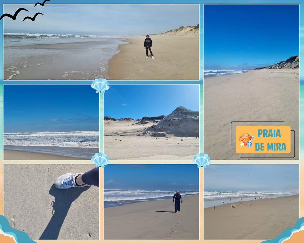
It certainly was a workout to trek down to the next beach at Poco da Cruz (POH-sah dah kroosh), around a four kilometre walk. There’s no settlement as such as Poco da Cruz, but there’s a lovely rocky breakwater. We took a break and sat on the rocks, drinking in the scenery sans people.

There’s also a super cool swing at Poco da Cruz. What an absolutely magical spot for a swing! The below photo is one of my favourites of our Portuguese wanderings. I have it as my phone’s home screen.

For reasons unknown – and perhaps not the best decision with the benefit of hindsight – we walked back to Mira along the main road that connects it to Poco da Cruz. The road runs adjacent to protected scrub and sand dunes.
We’d already walked eight kilometres that day, with the beach walk and lagoon loop that morning. The road back was an easy walk along a proper footpath, but it felt like an AGE before we made it back to the apartment. Google Maps tells me it’s a 5.8 kilometre distance. Yikes! I didn’t take any photos to document a slightly odd experience. I say odd as there is a mixture of restored and run down places along the quiet road and people selling random things like potatoes on the street. So Portugal!
The next day was cold and wet, the only day of our winter wanderings where the weather was a bit rubbish all day. We were so lucky with the weather otherwise. The morning was the better than the afternoon and we managed to brace the cold and the wind to take a walk down the southern side of the beach.

My photos show just how wild the beach was that day. I’ve never seen anything like Portugal’s beaches in winter. I was fascinated by the dramatic opera that is created by force of the Atlantic at that time of year.

Something distinctive to the Silver Coast is the spread of the sand from the Atlantic winds. The left-hand shot in the below collection shows W walking ahead of me at one of the boardwalks on the southern side of Mira. There are places where the sand covers the walkways. The other shot was taken on our first visit to Mira the previous May. I imagine it’s quite an operation to shift the sand around ready for the summer season. We could only walk a short distance that cold and windy morning as again there was heavy earthmoving equipment moving sand around and access was blocked.
The Silver Coast winds pick up between June and September due to the annual summer north wind phenomenon (nortada) combining with the exposed western coastline and powerful Atlantic Ocean currents.
The science of the winds also has something to do with the high-pressure systems over the Atlantic Ocean and the thermal low-pressure systems over the Iberian Peninsula during the warmer months.

We optimistically headed off late morning to explore the beaches north of Mira beyond Poco da Cruz. Unfortunately, the weather meant we didn’t have the best impression of those places, especially Praia de Vagueira. An attempt was made to go for a wander along the break wall that overlooks the beach, but it was freezing cold and super windy. The town lacked character as well - all concrete and brutalist architecture. Rain loomed large, so we found a place to sit for a car park picnic. What an odd place, with its giant slabs of apartment buildings reminiscent of old school Eastern bloc cities.

The weather took a turn for the worse and it pelted down all afternoon. The rain gave us the opportunity to take in our surroundings from the car. We ended up at Costa Nova and Praia da Barra in the Aveiro (ah-VAY-roo) lagoon. Later we had a poke around Viseu, one of the bigger towns inland from Mira.
I have included shots of the two beaches below. I am sure they are lovely in nice weather, but they were a tad depressing when we drove through. Costa Nova is quite well known for its colourful houses. I haven't included shots of Viseu. I understand it's another gorgeous historic town, but it was so gloomy that afternoon. To be fair, we were so lucky with the weather, with only one day of actual, proper rain.

The third day of our Praia de Mira wanderings saw the sun come out again. Yay! This was our final opportunity to enjoy the stunning Mira beach, so we walked all the way back down to Poco da Cruz. I remember sitting on the rocks at the breakwater feeling so at peace, just us there again, with the waves crashing around us. Our love for Portugal and for Mira was well and truly cemented then. The second time around made us feel even more at home there.

This time we made our way back to Mira along the dunes. This is a four kilometre walk but it felt much less arduous (and shorter) than our walk along the road two days earlier. I loved the dune walk! Parts of the walk are on a track of sorts (bottom shot below) and parts of it are a scramble in the scrub. We learnt that day to read the Portuguese-style route markers that led us to the boardwalk in the below collection, connecting the dunes to the southern end of Mira town.

Portugal leans into its shabby vibe, but it’s also super dedicated to preserving the country’s immense natural beauty. I loved that the “don’t step the dunes” sign shows this commitment to protecting the sand dunes. The plethora of boardwalks that have been constructed at Portugal’s beaches are another signal of this commitment. Mira and Pcoa da Cruz beaches have been awarded a Blue Flag every year since the program’s inception in 1987. The Foundation for Environmental Education runs the global program. Awarding of the flag means the site has met water quality, environmental management, safety, and education requirements.

A much welcomed rest in the afternoon watching a movie while the waves crashed on the beach across from the apartment gave us the chance to recharge before we headed off to the third base for our Portugal wanderings. We ended our stay at Mira on a high note with a second lagoon loop in the late afternoon. The lagoon took centre stage in the late afternoon winter light. We shared the path with a bunch of locals, losing track of how many times we said bom dia, feeling the warmth of the Portuguese people and the winter sun.

The street in the below shots is one of the side streets that leads into the esplanade, sitting parallel to the town’s high street. The apartments are quite new, and one was for sale when we were there. I have to admit that we spent a bit of time dreaming about what it would be like to own such an apartment.

A winter mountain adventure ⛰️
It was with some reluctance that we said adeus to Praia de Mira. The next base for our wanderings was to be Amarante (ah-mah-RAHN-tuh) in Northern Portugal. But first, we headed to the mountains at Estrela (esh-TREL-uh) for a day of exploring. The below map charts our journey, some 145 kilometres from Mira to Estrela then 200 kilometres to Amarante. The Estrela mountains were a wonderful discovery on our first Portuguese adventure, and we were keen to return to experience the stunning landscape again.

The highest point of Estrela is 1993 metres at the Torre (tower).
The mountains were created by a huge granite ridge that once formed the southern frontier of Portugal.
Three rivers have their headwaters in Estrela: the Mondego, the Zezere (a tributary of the Tagus), and the Alva.
The mountain range is 100 km long and 30 km wide, with 375 km of marked hiking trails.
The city of Seia (SAY-yuh) sits at the base of the mountains, then it’s a climb up to the summit, with views of traditional whitewashed Portuguese villages along the way. Beaches are cool, but it’s in the mountains where I truly feel connected to nature. There’s something about the majesty of their height, their expanse and their serenity that feeds my soul.

Our previous Estrela sojourn had been on a mid-week day in May. This time, it was a late Sunday morning in February. Two things confronted us as we neared the summit: the snow and the crowds. We’d seen remnants of the winter snow in May, but this time it was a full-on winter snow experience. I’m not sure what we were expecting, but it wasn’t THAT much snow. I think we may have audibly gasped as the white landscape loomed ahead of us.

The second thing that we were confronted with was the crowds. Our previous visit had been almost completely devoid of people. My photos don’t tell the full story, but we couldn’t believe how crowded it was that day. The final section of the road up to the summit was slow going, but we were kind of committed to it once we joined the long line of cars. Every piece of space was taken up by parked cars, and we wondered if we’d ever find somewhere to park ourselves.

It was rather awesome to be back at the summit, the Torre being the highest point in mainland Portugal. The empty car park of our first visit was completely full, and we had a long wait at the one tiny café and restroom at the top to use the facilities. After a very slow half hour or so of crawling to the summit and heading back down again (ready to give up, I might add), we were so relieved to finally find a car park.

Crazy traffic and crowds aside, we were SO EXCITED for our snow experience. Snow is a big deal to us as we live in a hot and humid part of Australia where winter only brushes by, never mind snow. How awesome is a picnic lunch in the snow!

We had an absolute blast stomping around in the snow. It was a rather surreal experience, being on top of the world immersed in a powdery landscape. I was surprised that it was chilly but not overly so. I was expecting it to be freezing when we got out of the car.

Being part of the Sunday snow experience with all the other people enjoying themselves was something I will never forget. It was especially magical as we weren't expecting it. Finding so much snow on the mountain was such a bonus!

Our main mission for the day was actually to do a hike at Comprida Dam, so the snow was absolutely a bonus. We’d discovered the dam on our first visit and had wandered around its edge, marvelling at the size of the structure and its pride of place at the top of the mountains. This time, we were keen to explore some more on foot.
Comprida Dam sits at 1600 metres, first constructed in 1912 from an ancient glacial lagoon, and later expanded in 1934 and 1966.
It serves as a vital hydroelectric power source as the largest water reservoir in the Estrela system.
There is usually 12-14 million cubic metres of water in the dam.
The structures is 28 metres high, 130 metres wide, and 2500 metres long.
We were so lucky to have had such stunning weather for our Estrela exploring. It was chilly at the summit, but the winter blue skies were stunning. A little further down at the dam was less chilly and perfect conditions for hiking.
The hike begins at the parking area off the main mountain road, where there are facilities, markets, and small shops selling Estrela produce. The below collection gives a sense of the hike, some of it traversed up rocky paths and other parts scrambling over rocks. This was my first outing with my new hiking pole (below bottom right-hand shot), and I was so glad of its assistance that day.

The late afternoon winter light brought out the beauty of that particular part of Comprida Dam. We shared the trail with a few other groups that afternoon, but it was hardly crowded, allowing us to bask in the fading light and truly appreciate our stunning surroundings.

The below collection is a snapshot of the magnificent scenery we encountered on our hike that day. Portugal, you sure are pretty!

I have to admit we couldn’t tear ourselves away from the little house we discovered on the hike. We sat for ages on some rocks contemplating its stunning location. Just imagine living there!

Here’s one final set of shots, giving a sense of the height of the dam and the mountain landscape. It really does feel as if you are on top of the world.

It was almost 5pm by the time we left the dam, and we still had a two-hour drive to Amarante. I’m not sure what Google Maps had in mind for us that evening, but we seemed to be initially taken on a series of backroads. It felt like we'd had a really long day by the time we arrived in Amarante. Our evening arrival was made smooth by the relative ease with which we found the apartment on Travessa da Boavista de Baixo. Host Fernanda’s clear instructions and friendly welcome via the Airbnb messaging app were also a big help.

Wanderings from our base at Amarante🌳
Our Portuguese winter expedition was planned for wanderings from three bases: Caldas da Rainha at the southern end of the Silver Coast, Praia de Mira at the northern end, and Amarante in Northern Portugal. We chose Amarante (ah-mah-RAHN-tuh) based on our love for the pretty town from our (albeit brief) first visit the previous May and for its central location in Northern Portugal. I was keen for the chance to experience winter in the northern part of the country.
Amarante sits astride the Tamega River within the Porto District on the western side of the Marao mountain range.
The town dates back to the Iron Age and holds a place of significance in Portuguese history. More on this below.
Amarante is in the UNESCO Creative Cities Network as a City of Music (since 2017).
The town has been part of the Romanesque Route since 2010. The region has lots of Romanesque architecture as structures were once built as meeting and resting places.
Waking up on our first morning gave us the chance to properly appreciate the views from our apartment, having arrived in the dark the previous evening. What a lovely surprise to wake up to! I’ve included shots that show the apartment layout with its windows into the world from the living area. It is my dream to one day have a house with a view like that.

The apartment is small but perfectly formed. We paid $475 AUD for four nights. The location was tricky from an access perspective, but in a great spot for exploring the town on foot. Like the Mira apartment, the interior is modern, with a reverse-cycle heating unit in the living area that we really appreciated, given it was much colder in Northern Portugal than at our other two bases. I always book places with washing machines as we travel light and I have a thing about washing regularly. Can you spot the washing machine? The apartment is too small for a laundry, of course, but the washing machine is cleverly placed in a cavity on the left side of bathroom wall, opposite the wash basin.

The morning light also showed us just how tricky access to the apartment is from the main road. The below collection of shots was taken across our four-night stay. I’ve tried to capture the adventure that is navigating the path to the building. It’s steep and narrow and parking the car involves some skilled driving. How W managed to manoeuvre the car into its parking spot in the dark on that first night is beyond me!

The first of our three days in Amarante was spent exploring the gorgeous town. The historic town centre is perched on the northern bank of the Tamega River, anchored by the bridge and the church of Saint Goncalo, named after a Portuguese Dominican priest, miracle worker, and matchmaker who lived from 1187 to 1259. Goncalo was beatified by Pope Pius IV in 1561.

The apartment we stayed in is located on the southern bank of the Tamega River. Its hilly location affords fabulous views of the river and the historic town centre, but that meant a trek down a steep hill and back up again each time we left to explore on foot. Another Portugal cardio stairmaster experience! The walk into the town centre, hills notwithstanding, is a smooth transition from new to old, past pretty residential dwellings and down to a street level view of the bridge and the church.

Ponte de São Gonçalo is a 50-metre iconic stone bridge featuring a striking arch design. At each end of the bridge there are two pairs of Baroque spires with epigraphic inscriptions marking the 1809 Battle of Amarante.
The present bridge was built in the late 1700s, replacing the original 13th century bridge that collapsed after the 1763 flood. There may have been an even earlier Roman bridge on the original Roman road from Amarante to Guimarães and Braga.
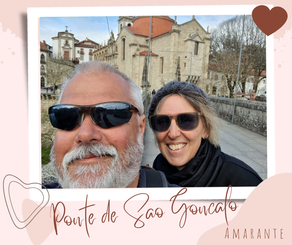
Old bridges have such personality, and I am especially fascinated by their history, their design, and their survival. As I walk across them, I wonder about who has come before me and what stories the bridge holds. The Ponte de São Gonçalo has a strong presence in Amarante’s history.
The 18th century Ponte de São Gonçalo famously defended the town against Napoleonic troops.
The town was the scene of heroic (but failed) resistance over two weeks in 1809 during the Peninsular War (1807-1814).
This resistance earned Amarante the Order of the Tower and Sword, now on the town's coat of arms.

Taking pride of place as the main monument in Amarante is Igreja de São Gonçalo, perched on the northern side of the bridge also named after the Dominican priest and patron of the town. The bridge and the church are the town’s focal point, with the bridge creating a threshold into the ancient place of worship.

The church of Saint Goncalo was founded in 1540 and completed in 1620.
The church's architecture blends Renaissance, Mannerist, and Baroque styles.
The bell tower was added in the 18th century.
The façade features a grand, ornate design with the distinct "Balcony of the Kings" displaying statues of four monarchs.
Above the side portal is a 30m high arcaded gallery, with 17th-century statues of Dom João and the other kings who ruled while the monastery was under construction.
The church is free to visit and for a small donation (€2), it is possible to explore the church tower and cloisters. I had noticed across our two Portuguese explorations that the churches have their own ornate beauty, but it’s rather understated, I think, in comparison to churches I have visited in other Western European countries.

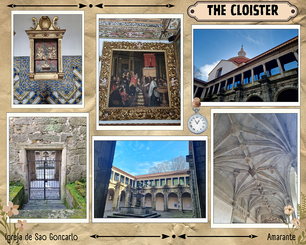
The below shots are my favourite of our interior exploration. I tried to capture different perspectives from the choir gallery as we meandered around the church, the only visitors at that time of the morning. I am not a religious person, but I appreciate the architectural marvels of places of worship and the elaborate and enduring artistry.

The church altar is decorated with heavy, glittering gold woodwork (talha dourada).
There are several colourful marble columns, side pipe organs, and traditional painted tiles (azulejos, pronounced ah-zoo-LAY-zhoosh).
Saint Goncalo’s tomb is housed in a tiny chapel to the left of the altar.
Local legend says that if you leave flowers by Sao Goncalo’s tomb, you can pray for good health and healing. Bonus points to help you seek what you find: Run around his tomb three times and pray.
One of the features of Portugal’s architectural beauty is its use of stone and the engineering ingenuity of the time that produced such lasting structures. As a history nerd, I always like to have photos of our explorations of such structures, to remind myself that we were there, that we walked where so many others have walked before us over the centuries.

Our entrance ticket for the 18th century church bell tower meant more climbing, but also the chance for magnificent views of Amarante and unique perspectives of the bells. There were even safety measures in place, in very un-Portuguese fashion!

The two-storey Renaissance cloister sits alongside the church, built at the same time as the house of worship. The church and cloister are all that remains of the original 16th century Dominican convent. Both structures have been declared a National Monument since 1910.
We wandered down to the Tamega after exploring the church, heading west on the northern riverbank. It was a beautiful morning for a walk, cold and crisp but with the winter sun starting to warm us up. The path we took is part of the Trilho das Azenhas, a 12-kilometre linear route along the riverbank. We didn’t walk the whole way to Vila Caiz at the end of the trail but at least had the chance to experience a small part of the route.

Our stroll along the Tamega that morning was just so pretty. Amarante is a small, compact town and in no time are you away from urban structures and wandering along cobblestone pathways astride the river.

It is possible to cross the river when the water is calm, but as my photos show, the Tamega was a little fierce that day. We ventured a little way out onto the stepping stones.

The Tamega at Amarante features a low stone weir that acts as a small barrier to control water levels, creating a beautiful and distinct feature of the river. The two right-hand shots below were taken on our first day wanderings from the north bank and the other two from the south bank two days later.

The Tamega River is a tributary of the Douro, originating in Galicia in Spain. It flows north to south into Northern Portugal until it joins the Douro River near its end point at Porto.
Tamega’s course covers a basin of 3300 square kilometres.
The river is prone to seasonal flooding. Amarante has had several major flooding incidents over the course of its history.
A dam was built in 2022 between Amarante and Mondim de Basto to harness hydroelectric power.
It seemed that our winter mountain expedition the previous day and our late arrival into Amarante had worn us out. A much-needed rest in the apartment in the afternoon helped to rejuvenate us before tackling the Portuguese hills again to walk to the Intermarche supermarket on the opposite side of the riverbank to our apartment. The distance is only 1.5 kilometres each way, but the route is pretty much down a steep hill then up another one. I strongly advise against travel to Portugal if hills aren’t your thing. Exploring the country on foot sure is an exercise in endurance! Still, up and down the Amarante hills was probably easier than getting the car out of the apartment’s parking space and navigating the narrow, steep driveway!

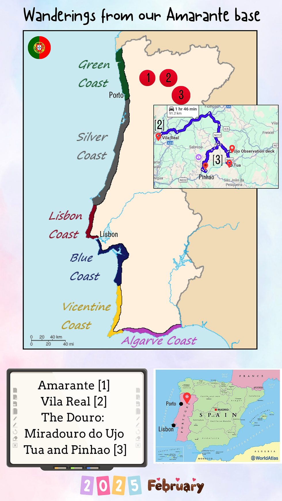
The next day we did venture out in the car, returning to the Douro Valley again. The below map shows our wanderings from our Amarante base. You can see where Amarante is located in Northern Portugal, inland from Porto. We explored Vila Real on our second day and the Douro (DOH-roo). Our Douro wanderings are charted in the map insert.
It was a foggy start to the day, but it was rather cool to experience a different perspective on Amarante from our apartment balcony. We came to learn over our winter expedition that the mornings can begin rather inauspiciously but later transform into gloriously sunny days with warm winter sun.

Vila Real is only 40 kilometres east of Amarante and another unique Northern Portugal city. We managed to find a park along the top of the escarpment and set about exploring the gorges below. Unfortunately, we scrambled down what we thought was a public pathway, only to be told by a local man that we were in the wrong place. Oops. At least we managed a conversation with the man in Portuguese, even if much of it was lost in translation.

Vila Real is located on a 450 metre high plateau, over the promontory formed by the gorges of the Corgo and Cabril Rivers.
The oldest part of the town is framed by the escarpments of the Corgo Gorge. Two mountain ranges – the Alvao and the Marao – overlook the town.
Vila Real has a 700-year history. It was once a place of nobility, particularly in the 16th and 17th centuries under the influence of the Marquis of Vila Real, the most powerful aristocratic house in Portugal at the time.
There are longer walks along the gorges, but I think we took a wrong turn at some point and ended up on the more built up side. Where I was hoping to go is the river walk shown in the top right-hand shot, but we couldn’t work out how to get there. Not to worry, it was still a lovely wander along the river on a cold, crisp winter morning.

The weather warmed up late morning and the sun came out, just in time for our wanderings around the historic old town in search of a supermarket for supplies. Our focus for the day was to be a hike in the Douro, so our exploration of Vila Real was somewhat brief. I’d love to return, as the historic centre is gorgeous and in pretty good shape for Portugal.

I’d done some research on miradouros (lookouts) for the best views of the Douro Valley and stumbled across Miradouro do Ujo, a viewpoint overlooking the Tua (TOO-uh) River, a tributary of the Douro River. The lookout sits 50 kilometres east of Vila Real. There was no one around – again! – as we made our way up a windy road to the lookout. I can honestly say that catching our first glimpse of the view literally took our breath away. I don’t think I have ever seen a more stunning view. I was mesmerised by it and could have stood there all day, drinking it in.

Better still is the incredible miradouro that has been constructed to take full advantage of the beautiful landscape. Ujo (OO-zhoo) is the Portuguese word for owl. The sweeping views of the Tua Valley and Tua River reservoir are 100% worth the drive to the lookout. And how cool is the actual lookout?

Miradouro do Ujo is a scenic observation deck in the Alijó municipality between the villages of São Mamede de Ribatua and Safres.
Ujo was opened to the public in May 2019.
The lookout is reachable by car via the EM596 road.
The Corten steel cantilever lookout was designed by architect Henrique Pinto and engineer Filipe Calisto.

We'd had so many beautiful views for our picnic lunches this trip, but the Ujo is easily the top of my list. Sitting at the picnic table with THAT view with the whole place to ourselves made me feel so peaceful.
We eventually dragged ourselves away to drive 10 kilometres south to Tua, a small village that sits at the confluence of the Tua and Douro rivers. Below is a shot of the gorgeous station, where we started our afternoon hike along the disused railway. Note the sign we passed along the way warning of the busy road. Nope. We hardly saw any cars that day!

Tua is a river in northeastern Portugal that flows through the Vila Real and Braganca districts. It is a tributary of the Douro.
The river is known for its scenic landscapes, winding through the rugged terrain of the Tua Valley. The valley is part of the demarcated Douro wine region.
The Tua line was a narrow gauge railway which closely followed the banks of the river. It was closed in 2008.
I absolutely love walking in winter sun, feeling the warmth of the sun without being overheated, especially if the day has started out cold. We were blessed with magnificent winter weather that afternoon for our hike from historic Foz-Tua station to the Foz-Tua dam in the Vale do Tua Regional Natural Park. It was such a cool experience to walk along the disused railway line and eventually see the dam loom large in front of us. The trail is just under three kilometres and is an easy walk, ensuring that you take care across the bits where the old railway line is disappearing.

The view of the Barragem (dam) de Foz Tua as we approached along the trail is rather impressive, but I do understand that the dam’s construction caused some controversial debate between the Portuguese government and environmental groups. The government claimed the dam would help alleviate Portugal’s dependence on imported energy and reduce greenhouse gas emissions. Environmental groups were concerned about the ecological impact on farmland, olive groves, and protected habitats.

Barragem de Foz Tua entered service in 2017 with a storage capacity of 11 million cubic metres.
The concrete, double curvature arch dam is 108 metres high and has a crest length of 275 metres.
There are two turbines that generate 251 MW of hydroelectric power.
The hydroelectric plant structures were designed by prize-winning architect Eduardo Souto de Moura to blend industrial minimalism with the rugged landscape.
Our hike took us along the disused railway to the dam then back along the riverbank, where the Douro and the Tua rivers meet. There are boardwalks to protect the landscape that allow close access to the magnificent river confluence. The river looked so pretty that day but then there is something about rivers that make me feel calm in a way that’s difficult to explain. Being beside a river quiets something in me and the steady movement of the water makes me feel present and connected to nature.

We had to backtrack to Pinhão (pee-NYOW) because..well…of the river! The map I included above shows our route. The 48 kilometre drive up and down hills gave us a second chance to appreciate the magnificent Douro Valley vineyards, first experienced on our trip the previous year. The vineyards were just as spectacular the second time around. It’s incredible to think they have been that way for hundreds of years, carving out enormous green steps on the hillsides. The below shots were taken on our way to Pinhao and back towards Amarante.

The Douro Valley is the world’s oldest officially demarcated wine region (since 1765) and is today a UNESCO World Heritage site.
The valley lies around 100 km east of Porto and is the birthplace of Porto wine.
Dramatic, steeply terraced vineyards are carved into slate-covered hills. Fortified (port) wine and a range of table wines are produced.
Wine was once taken downriver in flat-bottom boats (rabelos) to be stored in cellar barrels in Porto. Nowadays, port wine is transported from the Douro in tanker trucks.
Our expedition to Pinhão was ostensibly to search for a gift shop of some description as I was looking for a print of the Douro to take home with me. The town is tiny and nothing was open on a sleep weekday afternoon in February. Mission fail from a print purchase perspective, but a complete success in terms of more views of the stunning river.

Pinhão is a picturesque small town in northern Portugal, set in the heart of the UNESCO-listed Douro Valley wine region.
The town is located about 120 kilometres east of Porto.
Pinhão is known for its stunning terraced vineyards and port wine estates (quintas).
It is the main scenic riverside location in the region, where the Pinhão River meets the Douro, and is the jumping off point for river cruises.
Rivers are the lifeblood of Portugal. They are key to the country’s economy, supporting agriculture, power, and wine production. The Douro River weaves its way through the terraced vineyards in Northern Portugal, marking out the heartland of Portuguese wine production. It is also a popular tourist spot for river cruises and, understandably, wine-tasting.
I've made a map (not super accurate nor to scale!) that shows the path of the Douro and the Tagus, the two main rivers in Portugal. I've also charted the other rivers that have featured in this post.

The Douro River is the largest on the Iberian Peninsula by discharge, flowing from northern Spain into the Atlantic at Porto.
It is the third longest on the Iberian Peninsula at 897 kilometres.
For 112 kilometres the river forms the border between Spain and Portugal in a region of narrow canyons.
The river was personified as the god Durius during Roman times.
There are five major dams with navigation locks, built from the 1960s through to the 1980s.
Our final day in Amarante and in Portugal before heading back to Spain was spent wandering along the Tamega down a section of the Chestnut Trail. The trail is an ecological corridor that winds southwest along the southern bank of the river through a forested area to Salvador do Monte. The trail is eight kilometres long. We walked halfway, to the fishing spot at Formao (for-MOW). That was still just under six kilometres each way from our apartment.
There’s a mostly flat dirt marked path (below bottom left-hand shot) that hugs the riverbank, providing an easy trek down river. The first part of the walk takes you past another set of stepping stones and the rapid-flowing water that is directed by the weir. Further along the river is much quieter, with dense vegetation of chestnut (hence the trail’s name), oak, willow, and alter trees. While I loved the drama of Portugal’s winter beaches, I found so much peace in our river wanderings.

Here I am in my happy place, chilling out on a bench at the fishing spot, taking some time to enjoy the beautiful surroundings before we walked back to our apartment. Amarante does seem a popular place to visit, mostly as a day trip from Porto, I think, as there’s no easy way to get there without a car. However, we noticed how quiet the place was when we were there. It is certainly somewhere I would recommend if you are searching for peace and a pretty place to connect with nature.

The Chestnut Trail is worth wandering along for the views of the Ponte de São Gonçalo when heading back to Amarante. The below shots are my most enduring images of the town, one of my favourite places in Portugal. They are fairytale-like to me. There is magic in the reflection of light on the river from the historic bridge’s arches and the church standing as a sentinel on the northern bank of the Tamega. Portugal, you sure are pretty.

Our afternoon walk took us along the Nossa Senhora do Vau trail on the northern side of the Tamega’s riverbank heading northeast. The out-and-back trail stretches for just over eight kilometres and is made accessible by a bunch of wooden boardwalks. It is a popular trail for camping, hiking and running. We did pass quite a few people on our stroll. What a lovely way to end our stay in Amarante!

All Trails tells me there are at least ten scenic trails in the Amarante area to explore. Hiking, biking and strolling the trails is pretty much the thing to do in the town, after exploring the church and the historic centre. I’ve made a map to show the three trails that we explored, two heading southwest along both sides of the Tamega and the final wander northeast on the northern bank. The blue dots show where we walked to, although I've taken a guess for the middle one, the trail we walked on our first morning in the town.

Sadly, heading back to Australia 🥹
So, that was the end of our winter wanderings. Our second experience of Portugal absolutely cemented our love for the country. We sadly headed back to Spain to return to Australia after three magnificent four-night stays each in Caldas da Rainha, Praia de Mira and Amarante.
This time our flight from Madrid to Brisbane left in the evening, giving us essentially two days to make it back to the airport and return the hire car. The first morning of our two-day journey saw us drive from Amarante to Bragança (Bruh-GAHN-suh), our final experience in Portugal. This journey took us around 120 kilometres east across Northern Portugal to the Spanish border. The day was cold and bleak, and we felt it when we got out of the car at Bragança Castle.

Bragança's origins can be traced back to the Palaeolithic era. The city itself dates from the 10th or 11th century.
The city lies just 22 kilometres from the Spanish border, on a branch of the Sabor River.
King Afonso V established one of the oldest Portuguese fiefdoms there in 1442. The House of Braganca was founded then, the most powerful and wealthy dynasty in the country.
The municipality is part of the frontier of the Montesinho Natural Park, established in 1979 to protect the region’s ecosystem.
We had a plan to spend as much time as possible in Salamanca in Spain that afternoon, so we limited our exploration of Bragança to the castle. Unfortunately, although entrance into the castle keep and military museum is only €3, only cash is accepted at the ticket office. We’d survived the whole trip using our travel card, only bringing with us around €10 in cash that was left over from our previous trip. We gave the last of our coins to a windscreen washer at a set of lights in Vila Real two days earlier. There is no cash machine at the castle (at least not when we visited) and the ticket office attendant told us we’d have to go into the town to find the nearest one.
Travel tip 🌍
One of my travel tips for Portugal is to make sure you always have some cash on you as it can often be the only form of payment.
With some reluctance, we opted to avoid taking cash out at the back end of our trip and instead wandered around the freely accessible parts of the castle. It was still pretty cool to wander the castle walls. The 800-metre-above-sea-level height and the accessible castle battlements provide stunning views, even on a bleak day, of the Montesinho to the north, Sanabria to the west and the Castle of Rebordões to the east. The walls are reinforced by fifteen towers, including the Tower of the Princess (Torre da Princesa), a former residence with its own legend of a captive princess. My photos show how beautifully eerie and gothic the castle looked on that bleak winter’s day, especially once again sans other people.

Bragança Castle was built in 1409 on the orders of King João I on foundations established several hundred years earlier.
A key example of medieval architecture, the castle sits 800 metres above sea level. It is formed of an imposing 17-metre wide and 33-metre tall keep and a double wall.
The castle walls are constructed from masonry shale rock found across the region. The whole structure is a complex web of battlements, balconies, watchtowers, and turrets, all framed by Gothic windows.
The whole castle complex is known as Bragança Citadel, creating a fortified town enclosed by its two-metre thick stone walls. The Citadel has retained its medieval vibe and houses the castle, small, whitewashed dwellings, cobblestone lanes, and a Catholic church. That’s the church in the below collection - the Church of Santa Maria - built in Baroque style in the 14th century. It is Bragança’s oldest church. Not one to pass up the chance to admire an ancient door, I love the church’s entrance, surrounded by ornate wooden carvings. I also love the little wooden archways that join the whitewashed houses, forming an ancient portal into the town.

Adeus, Portugal (tristemente) 😔
Our winter wanderings were an incredible experience of Portugal’s natural beauty at a different time of year to our first trip. We headed over the border to Salamanca later that morning, excited to experience the city but also sad to be leaving Portugal. Our flight back to Brisbane left Madrid the following evening at 9.35pm. This was an even more brutal journey back across the world than the previous trip, as we had to fly via Barcelona. You can read all about our tortuous flight experience in my Spanish bookend post.
Adeus, Portugal, ate a proxima!


I've had the immense privilege to experience some parts of the world more than once. There is something different about the experience when you are returning rather than exploring for the first time. This was our second experience of Portugal and not as special as our initial discovery. That said, our winter expedition confirmed our love for the country and our understanding and appreciation of its essence. I wrote in my post on our first trip that it feels like there is such a dichotomy between Portugal's natural beauty and the air of decay and abandonment of many of its buildings and structures. I found this to be so on our second expedition. But it's this unashamed authenticity that is part of Portugal's charm. Our second experience only served to cement our strong connection to the country. It feels even more like home now in ways that are difficult to describe.

The privilege of a second experience of one of the most beautiful countries I have ever visited.
Cementing our love for Portugal and experiencing a different season.
Feeling so comfortable in Portugal and finding peace in the familiarity.
Navigating our way across Spain and around Portugal's hills and cobbled streets.
Experiencing a snowy Sunday in the mountains.
Picnics in magnificent surroundings.
Seeing first-hand two Portuguese versions of fixer uppers.
Capturing the essence of Portugal is hard to do with words. Portugal is more a feeling than a place. Its warmth enveloped us again, even in winter! I learnt again to appreciate the beauty of the country's natural landscapes and its architecture, in all its shabby glory. This time we had the chance to deepen our experience of the wild Silver Coast beaches and the richness of lush Northern Portugal. Below is a summary of my most vivid and lasting impressions of Portugal and its unique brand of living:

Driving up to Estrela's summit and finding it crowded with people and covered with snow.
Standing in awe of the drama of the winter waves on the Silver Coast.
The stunning landscapes of the Tua and Douro Valleys and the jaw-dropping views from the Ujo lookout.
Poking around in local supermarkets and being able to buy fresh, high-quality bakery bread for one Euro.
The hills. Always the hills! (And the steps...)
Our winter Portugal wanderings solidified our love of the country and our desire come back again. Check out my post on our first Portugal wanderings to learn more about why we love the place so much. I hope our expeditions have inspired you to visit Portugal and experience its natural beauty for yourself. Nos amamos-te, Portugal 💖.


Comments